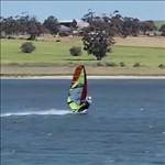
Hello All. Below is a short 3min video of GNDALERT. It's an advisory system that alerts a speed sailor of under water hazards like shallow water and star pickets etc. It also has a speed talker. The idea came about when a GPSTC rider had an off at George in February 2022, and ended up in hospital. I've been working on this project on and off since mid-2022, but the project has only gained momentum in the past year.
This project is still in its infancy, and at the moment, I'm exploring what's possible. I'm still trying to work out how to explain to somebody what it does !. I have many technical hurdles to over come before it can be taken on the water. I still need to determine if this demo will be any good, or if it's going to end up frustrating me.
Anyway, enjoy the video. If anyone is interested, I can post more info and keep you up to date with its developments.
Nb/ It's u-Blox/ESP32 based, just like Jan's ESP-GPS-LOGGER project, except my project does not have a display; it's audio based. Thanks to Jan's research on this hardware. The ESP32 is a very powerful micro controller, and very cheap and available. I tried to get away from the ESP32, but at its price, I can't for the job I need it to do.
Interesting project. I gave a fair amount of thought to adding a similar feature to my Datafield. My thought was to map out the safe area of Lake George and hard code it. Then sound the vibrate alert on the watch if you ventured too close to this area. The problem is though that the 'safe' area can change slightly from day to day and massively from year to year. There is a risk that any device like this may give a false sense of security. I decided I did not want other people to be relying on my dodgy estimate of water depth.
I like the idea of the loud audible alerts and the talking speed. It may well be a useful tool in certain locations, especially for people unfamiliar with an area. Good luck developing it further.
Have you considered integrating an echo-ranger depth sounder type unit for actual-really-real measurements? Would have to be angled forward for some advanced warning, and might be challenging to filter out the "noise" and entrained air associated with moving at speed...
Select to expand quotejn1 said..
Hello All. Below is a short 3min video of GNDALERT. It's an advisory system that alerts a speed sailor of under water hazards like shallow water and star pickets etc. It also has a speed talker. The idea came about when a GPSTC rider had an off at George in February 2022, and ended up in hospital. I've been working on this project on and off since mid-2022, but the project has only gained momentum in the past year.
This project is still in its infancy, and at the moment, I'm exploring what's possible. I'm still trying to work out how to explain to somebody what it does !. I have many technical hurdles to over come before it can be taken on the water. I still need to determine if this demo will be any good, or if it's going to end up frustrating me.
Anyway, enjoy the video. If anyone is interested, I can post more info and keep you up to date with its developments.
Nb/ It's u-Blox/ESP32 based, just like Jan's ESP-GPS-LOGGER project, except my project does not have a display; it's audio based. Thanks to Jan's research on this hardware. The ESP32 is a very powerful micro controller, and very cheap and available. I tried to get away from the ESP32, but at its price, I can't for the job I need it to do.
That rider would have been me..![]()
I haven't had a chance to read the post properly but will. Sounds like a great idea. ![]()
Thanks tbwonder. I think that an existing watch would be optimal if you can do that, since all the hard work of hardware design has been done. My idea is to make preset profiles for a given water level and wind strength. Once they are made, they are made (and can be shared). If it's easy to download/config them on a Garmin watch, then why not ?. The only thing with my design though, it will be adaptive with tides (ie: Stansbury, SA).
Sounds like other people have had this idea also. Maybe many more that have not read this post ?. I thought I would post what I'm up to. If somebody is already developing this, then I am happy to step down, and use their design and help them if they want help etc (no point two people releasing the same thing !). I was very happy to get the speed talker working in real life :). The ESP32 does it no sweat at all. Other than that, it's a slow burner project when I'm stuck at home.
That would be the ultimate solution ozzimark. But my application is sailing in 30cm of water, with the ground slant rising to 10cm water depth, over a distance of 200m. I don't know anything about depth sounders. I imagine multi path is going to be a significant error factor in 30cm of water with a forward angle of less than a degree. Do you know what the typical beam width, resolution and accuracy of a depth sounder would be ? (small and rugged enough to be epoxied on to the nose of a board). Can they measure down to cm's ?. Good idea to explore though. As you said, at least put a probe on the end of the board nose and see what's there (assuming the sounder meets the specs of the application). I didn't think of doing that.
Everybody else, thanks for feedback ![]()
Nice idea and I gather like a geo fence. But you would have to map individually every hazard and one persons too shallow is another's "let's go fast".
Select to expand quotekato said..
Nice idea and I gather like a geo fence. But you would have to map individually every hazard and one persons too shallow is another's "let's go fast".
Yes, that is correct. It's a geo fencing application.
Absolutely, the profiles ("mask files") will be an individual preference. I'll have to post another short video, as it will be easier to explain than typing pages of posts. I've written a backend suite of tools that produces these profiles, as well as validating these profiles using a graphical playback/simulation tool using GPS tracks (from KA72) that have a known fin size, wind and water state associated with them based on the GPSTC post (or simply asking somebody to email/thumb drive you their tracks and rigging info etc). I'm busy for a couple of weeks though. Watch this space.
I'm not sure exactly what you're proposing but some sort of warning approaching shallow water would be difficult?
I did a video once and I was sailing towards Cockies in clear water.
I talk in the video and I say ' whoa! It's getting shallow!'. I then check around before I gybe, get myself organised and gybe. In that time I must have travelled 300m plus?
I was on the big gear and probably only doing 20 - 22kts speed...
So alert from the device, noticing it and then taking action time in the equation. I suppose you could bail out or do an emergency stop..![]()
Thanks to storms and tides, the topography of the bottom is always changing. Geofencing won't address this... what we need is a way to find the new sand bar without hitting it first.
Select to expand quotejdfoils said..
Thanks to storms and tides, the topography of the bottom is always changing. Geofencing won't address this... what we need is a way to find the new sand bar without hitting it first.
Very true, but I'm not sure if it's doable for a small user friendly windsurfing device.
But for known fixed hazards, (we have plenty here, sometimes marked with plastic posts, that intermittently disappear for unknown reasons). Geo fencing could save potentially expensive damage to rig and rider.
Select to expand quotesboardcrazy said..
I'm not sure exactly what you're proposing but some sort of warning approaching shallow water would be difficult?
I did a video once and I was sailing towards Cockies in clear water.
I talk in the video and I say ' whoa! It's getting shallow!'. I then check around before I gybe, get myself organised and gybe. In that time I must have travelled 300m plus?
I was on the big gear and probably only doing 20 - 22kts speed...
So alert from the device, noticing it and then taking action time in the equation. I suppose you could bail out or do an emergency stop..![]()
In that video, how many seconds past between you saying that and then gybing ?
jdfoils: We have a spot in SA called the Mouth. It's a river entrance, and there are dredgers there running pretty much constantly. There is no point using a geo fencer at a spot like this because of the constantly changing subterrain. So if you are riding in locations like the Mouth, then I agree.
Warning. Warning. Turtle. Woooop. Wooop. Wooop. ![]()
Nice idea. I liked watching the vid.
Select to expand quoteelmo said..
And keep the riff raf out of the really good spots![]()
Oooooo Great idea ![]()
![]()
Select to expand quotejn1 said..sboardcrazy said..
I'm not sure exactly what you're proposing but some sort of warning approaching shallow water would be difficult?
I did a video once and I was sailing towards Cockies in clear water.
I talk in the video and I say ' whoa! It's getting shallow!'. I then check around before I gybe, get myself organised and gybe. In that time I must have travelled 300m plus?
I was on the big gear and probably only doing 20 - 22kts speed...
So alert from the device, noticing it and then taking action time in the equation. I suppose you could bail out or do an emergency stop..![]()
In that video, how many seconds past between you saying that and then gybing ?
jdfoils: We have a spot in SA called the Mouth. It's a river entrance, and there are dredgers there running pretty much constantly. There is no point using a geo fencer at a spot like this because of the constantly changing subterrain. So if you are riding in locations like the Mouth, then I agree.
I'll have to watch the video. May be a few days as I'm in getting an operation.
Could the fencing Be set and then updated By using Ka72 posts, looking at some posts it gives you a fair idea of where you can sail And This could change as more posts became available ,Using the stop and turn points, Maybe a bit too tricky to achieve
Trouble is people stop and turn for multiple reasons, not just not enough water.
Select to expand quoteMobZ said..
Warning. Warning. Turtle. Woooop. Wooop. Wooop. ![]()
Nice idea. I liked watching the vid.
Thanks. Yes, that is the same as shallow coastal spots here and Lake Alexandrina. Sting rays and carp respectively.Select to expand quoteanthony perkins said..
Could the fencing Be set and then updated By using Ka72 posts, looking at some posts it gives you a fair idea of where you can sail And This could change as more posts became available ,Using the stop and turn points, Maybe a bit too tricky to achieve
Definitely live updating is possible in software. You could make a filter that processes that data to base an inclusion zone on most probability etc. However, as decrepit alluded to, if somebody stops the other side and wanders to land, then without a filter, a fully automated method is going to cause a false inclusion zone. So anything that is fully automated, a user would have to review the profile before using it.
The best hazard alert device out there is the sailors's experience, eyes and brain. I'm unconvinced that GNDALERT could get close to providing any reliable input.
Select to expand quoteJohn340 said..
The best hazard alert device out there is the sailors's experience, eyes and brain. I'm unconvinced that GNDALERT could get close to providing any reliable input.
Trouble is, it's not an experience that's all that advisable to have!!!!
The usefulness of the watch would all depend on the data, once hazards are accurately mapped and included in the watches data base, I'm sure it could work well.
But first, all the hazards have to mapped.
Drain Lake George and it would be easy there.
We tend to stick plastic pipes in here, not all that easy to see if the sun's on the wrong side, but definitely helps.
Select to expand quotedecrepit said..
But first, all the hazards have to mapped.
Drain Lake George and it would be easy there.
Done. Mother nature just drained it for you. Go at it! ![]()
Select to expand quotedecrepit said..John340 said..
The best hazard alert device out there is the sailors's experience, eyes and brain. I'm unconvinced that GNDALERT could get close to providing any reliable input.
Trouble is, it's not an experience that's all that advisable to have!!!!
The usefulness of the watch would all depend on the data, once hazards are accurately mapped and included in the watches data base, I'm sure it could work well.
But first, all the hazards have to mapped.
Drain Lake George and it would be easy there.
We tend to stick plastic pipes in here, not all that easy to see if the sun's on the wrong side, but definitely helps.
Mike,
By experience, I don't mean necessarily running into things, although sometimes in my case that has helped! I know where Rod's rock garden and the submerged rocks near the islands and Kev's corner are! But you don't need to hit these rocks to know where they are. Talking with regulars certainly helps. Further the condition of the lake changes each year with different water levels and extent of weed. At the start of each year I do a recognisance of the sailing areas, stepping off in the shallow areas and taking note where others are sailing and who they are. For example, I don't necessarily follow sailor A's speed run line because I know he runs a much smaller fin that me. It's a big lake and there is plenty of safe flat water to have fun. This is what I mean by experience.
Further for these hazards to be dangerous you have to hit them at speed, hence the warnings would have to early enough for you to take corrective action.
If someone did the work, then I certainly add it to my information store. But it would be dangerous to rely on soley.
Select to expand quoteJohn340 said..
If someone did the work, then I certainly add it to my information store. But it would be dangerous to rely on soley.
Yes indeed!!!!
Select to expand quotejn1 said..sboardcrazy said..
I'm not sure exactly what you're proposing but some sort of warning approaching shallow water would be difficult?
I did a video once and I was sailing towards Cockies in clear water.
I talk in the video and I say ' whoa! It's getting shallow!'. I then check around before I gybe, get myself organised and gybe. In that time I must have travelled 300m plus?
I was on the big gear and probably only doing 20 - 22kts speed...
So alert from the device, noticing it and then taking action time in the equation. I suppose you could bail out or do an emergency stop..![]()
In that video, how many seconds past between you saying that and then gybing ?
jdfoils: We have a spot in SA called the Mouth. It's a river entrance, and there are dredgers there running pretty much constantly. There is no point using a geo fencer at a spot like this because of the constantly changing subterrain. So if you are riding in locations like the Mouth, then I agree.
Including the gybe 30 seconds @ roughly 19-20kts speed on the big gear.
Select to expand quotejn1 said..sboardcrazy said..
I'm not sure exactly what you're proposing but some sort of warning approaching shallow water would be difficult?
I did a video once and I was sailing towards Cockies in clear water.
I talk in the video and I say ' whoa! It's getting shallow!'. I then check around before I gybe, get myself organised and gybe. In that time I must have travelled 300m plus?
I was on the big gear and probably only doing 20 - 22kts speed...
So alert from the device, noticing it and then taking action time in the equation. I suppose you could bail out or do an emergency stop..![]()
In that video, how many seconds past between you saying that and then gybing ?
jdfoils: We have a spot in SA called the Mouth. It's a river entrance, and there are dredgers there running pretty much constantly. There is no point using a geo fencer at a spot like this because of the constantly changing subterrain. So if you are riding in locations like the Mouth, then I agree.
Video - from 1.39 mins.
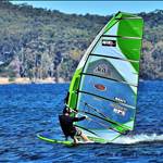
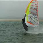
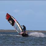
Lake George in nice conditions..![]() 2020
2020
Select to expand quoteJohn340 said..
The best hazard alert device out there is the sailors's experience, eyes and brain. I'm unconvinced that GNDALERT could get close to providing any reliable input.
I agree with you yes and no. My work only lets me go 4 days per season if I'm lucky. So 4 days per year is not enough time to get experienced. The algorithm I am using is not perfect (it will never beat experience). I'll explain the video, which should not be too far away now for me to do it.
Thanks sboardcrazy, that is good to know other sailor's reaction time.
Select to expand quotejn1 said..John340 said..
The best hazard alert device out there is the sailors's experience, eyes and brain. I'm unconvinced that GNDALERT could get close to providing any reliable input.
I agree with you yes and no. My work only lets me go 4 days per season if I'm lucky. So 4 days per year is not enough time to get experienced.
The main submerged hazards on the lake are easily avoided. They are listed in order of danger
- The submerged rocks in Kev's corner
- The submerged rocks around the perimeter of the two islands between The Spit and Cockies Pt
- Rod's Rock Garden ~400m south of Cockies Pt
- Like any location, shallow water around the perimeter of the lake
The two serious injuries in recent years could, as Jimbob has said, been easily avoided by application of common sense.
Other hazards such as infection from fin cuts and collision with other sailors are arguably more dangerous.
My first runs out for the very first session each season is normally the problem. Last January, it was Rod's rock garden. I didn't run aground, but James and Danny commented to me just how close I came (I was running a 16cm delta). The year before, 1st run, and over the handle bars. Year before that, same thing. 1st run. Seriously hurt my foot. Year before that (the magic season - 2022), guess what ?. Yep, you guessed it. 1st run. January 2019, yep. 1st run. All these times, I was being really really careful, and completely aware of the hazard. But, they caught me out. I just don't sail there enough.
Anyway, see video below. Apologies for my awesome radio voice. But I'm hoping this video will save me typing 1000's of words in order to send down the main point.
Nb/ This is a demonstrator project. It is exploring possibilities. At the end of it all, if I don't get the desired outcome, I'll end up putting it on the shelf and forgetting about it.