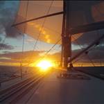
To see my tracks, I save my data from RealSpeed as a GPX file, which is the default anyway. Start up Google Earth and then drag your GPX file into it off your desktop. Google will then spin around and zoom into where you sailed and show your tracks, nifty ![]()
I can't believe that Googlemaps does that!!! I've been trying to drag them and fit them onto a BMP!!!
That's awesome, thanks for letting me know!!
I can drag a GPX file in, it appears in a folder under temporary places, but I cant see anything. The GPS option in the tools menu says I need the Google Plus Version, am I being a gumby and doin somethin wrong ![]()
Had to upgrade to the latest version, either last version did'nt do it or my install was stuffed. Now I can see exactly where I crashed ![]() Cool
Cool ![]() ThanX
ThanX
i know this isn't too far off topic but since i use a foretrex201 i saw a vid on dave w.'s foretrex wherein he changed the time interval i think to 2secs. instead of the defaulted i think 3 or 30mins..so my question what does this do since i really don't upload and watch tracks and the speeds....cheers
Cool Trick
Didn't know you could do that
It is scary to see just how much the sandbars at safety bay have moved since the photo was taken
i see what all the fuss is about.
Here is the tracks from my best day 5 PB's and a 31.88knt NM on the 15.09.07
YYYYYYyeeeeeeehhhhhhhttp
://www.seabreeze.com.au/gallery/gallery.asp?imageid=7064
OK Bender, you started it, work this one out ![]()
www.seabreeze.com.au/gallery/gallery.asp?imageid=7065
Goodnight from FNQ
before you save the image next time.
right hand mouse click on the GPX file which you have loaded up in google e
bring up properties,
in there somewhere there is the option for changing the width and colour of the track
can make the detail of the tracks a lot easier to see.
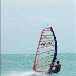
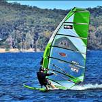
Speedsailing at Sandy Point on an Easterly
Sorry. I think I set the quality a bit low!
www.seabreeze.com.au/gallery/gallery.asp?imageid=7078
There you all go- fastest spots to sail around Brisbane. Pity all of the banks have big kinks in them. No secrets now ![]()
Thank's Elmo another handy hint ![]()
Thank's also mkseven & frant, didn't realize I could do it via the menu ![]()
This method allows SBN files to work, where the drag & drop method didn't.
Interesting tracks in the photo section guys, it gives me an idea where you all sail ![]()
Hey Bender, those tracks of mine were when I got my distance PB, one K less than your Pb ![]()
Added a spot from Sunny Coast, we are workin on a library ![]()
www.seabreeze.com.au/gallery/gallery.asp?imageid=7088
With the help of a teenager![]()
www.seabreeze.com.au/gallery/gallery.asp?imageid=7089&text=willow
Ive just added a track from burrum heads.
now doesnt that place look awesome.![]() ]
]
www.seabreeze.com.au/gallery/gallery.asp?imageid=7103
With the help of a teenager
When I get one of thoses I,ll post my 309km coloring book from the Pit
The track is of Sean Obrien sailing on the gps weekend back in April.
unfornunatly for him we had more wind down here![]() .
.