The idiots guide to using a GPS, by the biggest idiot of them all...Roo.......
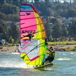
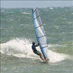
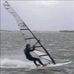
So you want sail fast...real fast. Not the usual BaFing (Backwards and Forwards) but real balls to the wall...off the wind sailing. If you're really serious..take a deep breath, clench your butt cheeks, turn the board at least 110 degrees off the wind, sheet in and hold on. Five hundred meters later you may be the new world speed record holder, but how will you know unless you've entered one of the three ISA speed contests to be held this year or there's a GPS receiver strapped to your arm. Glancing down at the screen if you see a number higher than 40 knots you know you're seriously quick, any less and you've got some work to do. That number on the screen is just the beginning, inside the GPS is a record of all your runs and, with careful analysis, the key to making you the Speedy Gonzalez of your beach.
Choosing a GPS is your first step. What you need is a unit that saves a track log of your runs and can record your position every second. You also need to ask yourself how serious you are about analysing and improving your speeds.
If you're a recreational sailor who just wants to take a few beers off your mates in informal speed contests then something like the Garmin Foretrex 101 or 201 and Gecko is ideal for your needs. While the box it came in tells you its waterproof don't be fooled, you need an Aquapac to protect the GPS and keep the water out. The Aquapac Pro Sports Mini is ideal, it comes with an arm band so you can strap it onto your forearm or bicep and watch the speed as you sail. The Foretrex comes with a cradle for recharging the battery and downloading data via a serial port on your computer. If you have a newer PC you may need a Serial/USB adapter to allow you to download the track log. The Garmin is fairly old technology so has a built in error that varies your speed somewhat, over longer runs it averages out but for instantaneous speeds don't bet the farm on its accuracy. With recording set at 2 second intervals software analysis cleans up the data but there will be few spikes from falls, catapults and swimming that need to be removed.
If you've got Finian Maynard in your sights then the new generation of NMEA recording GPS devices is the way to go. They keep a record of the satellites used to generate your instantaneous position, their level of accuracy and your Doppler speed (actual speed at the time rather than calculated later). The data can be verified and one day may even be valid for certifying a world record. The best unit available is the NAVi GPS, it has a slot for a SD card, the SanDisk make is recommended, to record all the data which can then be removed and plugged into a computer for analysis. Like the Foretrex you will want to put it in an Aquapac, the larger Pro Sports seems to fit best. These GPSs are the most accurate available, and provide data you can rely on. The development of their use and software to analyse them was done in the US by the author and has been tested extensively around the world. For around $300 you can get a kit with the GPS, Aquapac, SD card, USB SD card reader, USB cable and car charger.
Once you made your runs, scared yourself silly, and bagged bragging rights at the pub from your speed readout on the gps screen, it's time to download the data and analyse your performance. There are a couple of free programs available designed for just this function. Easiest to use is RealSpeed,www.intellimass.com/RealSpeed/Single.htm , written by Aussie speedster Mal Wright. It works with both the NAVi GPS and Foretrex on PC's running Windows. Action Replay, gpsactionreplay.free.fr/index.php?menu=2 , by Frenchman Yann Mathett also does the job and allows you to load maps or digital images downloaded from Google into the program so you can see where you sailed. It is a Java based program and is trickier to load onto your computer but will work on both Windows and Mac systems. If you just want to download the data from your GPS and send it to someone else to analyse try G7ToWin, gpsinformation.org/ronh/ , it's also free and works with all units. If you're willing to pay for great features have a look at GPSResults from Manfred ****hs in Germany, www.gpsresults.com/download_e.html , he has versions for PC, MAC and PDAs. It combines the best features of GPSAR and RealSpeed and is optimised to work with NMEA data.
If you've made it this far you'll find the following step by step guide handy for setting up your GPS before you head off to the beach for the first time. There's a few simple things to remember, make sure your battery is fully charged before each session, turn it on at least 10 minutes before sailing so it can lock onto all the satellites in your area and check to see the unit is switched on as you step into the water.
The K.I.S.S. (Keep It Simple Stupid) guide to setting up the NAVi GT-11 for Speedsailing
The NAVi GT-11 is a fantastic little unit that has the highest level of accuracy of any GPS we use for speedsailing when set up correctly.
It wasn't designed specifically for our needs but firmware revisions have turned it into a potent little device.
All the features and menu screens may seem a bit daunting at first but here's a simple guide to setting it up that will have you on the water and downloading data in no time.
Charge the battery
Once you've unpacked your NAVi open the flap on the bottom of the unit and plug the small end of the USB cable into the mini-USB slot on the right hand side next to the slot for the SD card.
Plug the other bigger end of the cable into the USB slot on your computer.
A battery icon will appear on the screen to show that it is charging. It will go solid when fully charged and flash while charging.
The units come from the factory with the built-in battery charged up but I find it best to leave it charging for an hour or so just to make sure it is topped up.
A full charge from empty will take about 4 hours.
You can also charge it with the car adapter, plug it into a cigarette lighter socket and connect the USB cable.
A full charge will last several days of use but best to keep it topped up.
Read the manual
While it's charging go online and read the manual, it will give you an idea of what the unit is capable of.
You can find it here www.locosystech.com/download/handheld/GT-11%20Owner%27s%20Manual%20ver%201.01%20English.pdf
All the features you need for speedsailing are covered in the manual, but there are a few extra features that have been added with firmware revisions.
If anyone needs any help on these just ask.
For Speedsailing we will only be using four of the the many menus the GT-11 has available.
These will be "SETTINGS", "MEMORY CARD", "TRACK" and "TRIP METER"
Configure the system, "SETTINGS"
Time to configure the unit, basically tell it how to perform in public and do the things we want it to.
Turn the gps on by pressing and holding down the small button just below the thumb stick.
The unit will power up with menu icons on the screen "SAT SIGNAL" will be written just below the icons.
A box may appear on the screen asking if you are "INDOORS", select "YES" with the thumb stick, this will allow you to set up the unit without it trying to get a fix on satellites.
Using the thumb stick move it up/down or left/right to move through the menu icons until you get to "SETTINGS"
Press the thumb stick in to select "SETTINGS"
The first item highlighted will be "LANGUAGE" "ENGLISH" is the default setting and will be listed at the bottom of the screen, leave it as it is.
Move the thumb stick down to select the next item "FUNCTION" The default setting is "NAVIGATION" leave it on this setting and it will store all the data from the satellites without any filtering.
Next is "TIME FORMAT" select whether you want 24 hour or 12 hour by moving the thumb stick left/right.
"DATE FORMAT" is next, you have a choice between day/month/year, month/day/year or year/month/day.
"TIME ZONE", this setting helps out the GPS and lets it know roughly where it is in the world so it can look for the right satellites. You can choose from a list of cities or select "+Others" it will allow you to select the number of hours your location is ahead/behind "GMT" the time in London.
"UNIT" will determine how speeds are shown on the screen, "NM" for nautical mile will give readings in knots, "FEET" will give miles per hour and "METRE" will produce kilometres per hour.
Leave "ARRIVED", "MAP DATUM", "POSITION" and "USER GRID" on their default settings, we have no use for them.
"POWER MODE" should be left on the default setting "NORMAL" for full performance from the gps, "LOW POWER" is a power saving mode that shuts down some functions of the gps.
"OFF" is the default setting for "DGPS SOURCE", this is for differential correction of satellite data, the only place you can pick up satellites that provide this is in the USA, it improves the accuracy of positional fixes by correcting with data sent from 4 special satellites.
"INTERFACE" is used when connecting the gps to navigation systems, default is "NMEA"
"BACKLIGHT TIME" allows you to select how long the backlight stays on after a button is pushed. It can be overridden at any time by pressing the on/off switch, "10 SECONDS" is the default.
"CONTRAST" controls how bright the display will be, adjust it for your location by moving the thumb stick left/right.
"EXT.POWER MODE" controls how the unit performs when plugged into a computer, leave this setting "OFF".
"USERNAME" allows you to enter your own name for the gps with up to 13 characters.
"USAGE" cannot be changed, it tells you how many "Routes" and "Waypoints" are stored in flash memory.
"SERIAL NO." identifies the unit and cannot be changed.
"VERSION" tells you what "Firmware" is loaded on the unit. See the manual for loading new "Firmware"
Now press the on/off button to get out of the "SETTINGS" menu.
I like to switch the unit off now to make sure my configuration is stored in the unit's flash memory, hold down the on/off button until "SYSTEM OFF.." appears in a box on the screen.
Initialize the receiver
Even though the GPS is a pretty smart little unit to begin with, it doesn't know exactly where you are located on the planet, giving it a few hints helps things along.
Setting the correct time zone in "SETTINGS" gives it a rough idea.
Take the unit outside and turn it on.
Leave it with a clear view of sky until it has fixed its position, this may take up to 15 minutes the first time.
After that, it needs only around 45 seconds to find its location each time you switch it on.
When the unit has not been used for long time, or you move a long way from where you initialized it, you will need to re-initialize the unit before use.
Recording NMEA data to the removable SD "MEMORY CARD"
Now you've set you GPS up with your personal configuration you need to tell it how and what data to record to the SD memory card.
We want to set the unit to record track points every second.
You'll use this data after sailing to analyse your sailing session and see just how fast you've gone.
Using the thumb stick move it up/down or left/right to move through the menu icons until you get to "MEMORY CARD"
Press the thumb stick in to select "MEMORY CARD"
The first item highlighted will be "LOG SWITCH" default is "OFF" leave it on this until you have set all the other "MEMORY CARD" functions correctly.
Use the thumb stick to highlight the next selection "NMEA ITEMS", push in the thumb stick to bring up the menu that allows you to select the NMEA items to record.
First up is "GGA", move the thumb stick sideways until it shows "GGA 1SEC"
Move the thumb stick down to highlight "GLL" then again move it sideways until "GLL 1SEC" shows.
Keep going and in the same way select "GSA 1SEC", "GSV 1SEC", "RMC 1SEC" and "VTG 1SEC", leave "ZDA" OFF.
Press in the thumb stick and a box will appear asking you to "SAVE" Select "YES" and press in the thumb stick.
Move down to "FILE SIZE" and move the thumb stick sideways to select "CARD SIZE"
Now you can put in your SD card, open the cover on the bottom of the GPS and put in the SD card with it's face right side up.
Select "FORMAT CARD" from the menu, a box will appear with "FORMAT CARD" in it, select yes.
Once formatted correctly a box will appear saying "SUCCESS". If the card fails to format correctly, switch the unit off and on then try again.
The next menu item is "REMOVE CARD", select this if you want to remove the SD card while the unit is one, it will complete writing any data to the card and a box will appear on the screen with "REMOVE CARD" Push in the thumb stick to select "OK"
Move back up to "LOG SWITCH" and select "ON" by moving the thumb stick left/right.
The unit is now set up to automatically record data as soon as it is turned on.
Press in the on/off switch to get out of the "MEMORY CARD" menu.
Recording NMEA data to GPS flash memory "TRACK"
The GT-11 will save a copy of your trackpoints to on-board flash memory, it can store up to 8192 records, that's over 2 and a quarter hours at 1 second intervals.
Once the memory is full it will stop recording until reset.
The information is not as detailed as the NMEA data on the SD card but serves as a backup.
Using the thumb stick move it up/down or left/right to move through the menu icons until you get to "TRACK"
Press the thumb stick in to select "TRACK"
Press in the thumb stick again to bring a menu box up on the screen, scroll down and select "INTERVAL", push in the thumb stick to select.
Another menu box will appear, scroll down and select "1 SECOND", push in the thumb stick to confirm your selection.
To clear the memory of data press in the thumb stick to bring up the menu box and scroll down to "CLEAR" and select.
A menu box will pop up with "CLEAR", select "YES" and press in the thumb stick, all data will be removed from on-board flash memory.
Press in the on/off switch to get out of the "TRACK" menu.
Turn off your GPS to store all the settings in memory.
You have now successfully set up your NAVi GT-11 ready for your next speedsailing session.
Pre Speedsailing Checklist
Make sure you've charged your GPS.
Turn it on at least 10 minutes before sailing to get a good satellite fix.
Check to see if the SD card is inserted and data is recording, if you've followed all the above steps when you turn the GPS on a box will appear on the screen saying "CARD FOUND" and a few seconds later "NEW FILE"
Make sure your backlight has turned off, press in the on/off switch to turn it off.
If you want to save data to the onboard memory as a backup make sure you "CLEAR" it from the "TRACK" menu so you have enough space.
Monitoring your performance "TRIP METER"
One of the best features of the NAVi is the detailed speed information it gives you on the water.
The onscreen speed display is extremely accurate, it reads Doppler speed from the satellite information and updates it many times per second.
It is also displayed to 2 decimal places and available in large screen format for easy viewing.
Using the thumb stick move it up/down or left/right to move through the menu icons until you get to "TRIP METER"
Press the thumb stick in to select "TRIP METER"
First screen up is "TIME NOW", it is the current time at your location based on the "TIME ZONE" you selected in "SETTINGS".
Move the thumb stick down to bring up the "STOPWATCH, push the thumb stick in to select "COUNT" or "ZERO"
"TRIP MAX SPEED" comes up next, to reset push in the thumb stick and select "YES"
"TRIP AVG SPEED", "TRIP TIME" and "TRIP ODOMETER" all follow, resetting any of the "TRIP" screens resets all the "TRIP" readings to zero.
"ODOMETER" and "TOTAL TIME" will give you the combined distanced traveled and time recorded when the unit has been switched on. Both can be reset to "ZERO" by pushing in the thumb stick.
The next 4 menu items are in large digit format for easy viewing, they are "SPEED", "TRIP MAX SPEED", "ALTITUDE" and "TIME NOW"
Now its time to get on the water, point your board far off the wind, clench your butt cheeks, sheet in and hold one.
Rest assured your GT-11 will be faithfully recording your every move, as one speedsailor I know often says....once the data drops the bull**** stops!
The NAVi is a great little unit, treat it well and set it up correctly and you'll be rewarded with extremely accurate speed data.
Screw with it and change settings without any knowledge of their purpose and you'll end up with a jumbled mess!
Roo's dummies guide to downloading and analysing data
If you've been good speedsailors and read Roo's guide on how to set up your NAVi GPS you'll be ready to download your speeds and claim some of the booty Hardie has stashed for prizes in the Speed Challenge.
However if our illustrious leader Hardie had trouble reading the instructions then what hope do the rest of us have!
This time I'll try and keep it simpler, if that's possible, so we won't have to embarrass Hardie again.
Even though the NAVi GT-11 is pretty user friendly it still has a few quirks when it comes to getting it to spit out information. As you will have seen in the setup instructions it can store your speedsailing track log both internally in memory and also at the same time record it to a SD card that hopefully you put into the unit before you went sailing.
SD Card removal
We'll deal with getting the track log off the SD card first. Before removing the SD card make sure the unit is turned off, if you don't it may corrupt the data on the card.
Open the flap on the bottom of the GT-11; find the card in the slot on the left side and push in the SD card and it should spring free.
We are now going to transfer the card to a computer so we can retrieve the data. If your computer has a SD card slot simply insert it and you are ready to go.
For those without a built in reader you will need to buy a SD card reader that will plug into a USB slot on your computer (you can find them at most Harvey Norman/Computer superstores for around $20). Insert the card into the reader then plug it into a free USB slot on the front/side/back of your PC and you are ready to go.
Loading the software
If you haven't already downloaded a copy of RealSpeed, download the compressed .zip file from here http://www.intellimass.com/RealSpeed/1.804/RSpeed%201.804.zip
Once you have copied or extracted all the included files to a folder, run RSpeed.exe and go to "Tools" in the Menu and select "Register" to find your computers "machine ID" number.
You need to send this number to info@intellimass.com with your name and RealSpeed will send you back a registration ID.
Go to "Tools" in the Menu and select "Register"
Enter the license number into the box below "2. Enter the license number that you received:"
Click "OK" and the program will be fully enabled.
Now you are ready to analyse your tracks and see if Finian should start getting worried!
Opening Speedsailing track logs
Click on "File" in the menu and select "Open"
When the dialog box comes up click on the arrow to the left of the "Look in" box.
Select the drive your SD card is listed as (usually Removable Disk (E:) or (F:))
It will bring up a directory in the box below that says "GPS_DATA"; this is the default directory on your SD card the track files are saved in.
Double click on this directory and the track files will be listed.
The last six digits of the file name indicate the time the file was created; pick the one which corresponds to when you were out speedsailing.
Click "OK"
RealSpeed will now load the file, be patient it may take a few seconds.
Setting up divisions
The first time you use RealSpeed you will need to set up the categories you want it to analyse your data for, otherwise known as "Divisions"
RealSpeed comes with "Divisions" for 2 sec peak, 5 x 10 sec average, 10 sec, 100 m, 250 m, and 500 m, pre-selected.
For the Speed Challenge you will need to add "Divisions" for "1 hour" and "Nautical mile".
To add a "Division" select "Edit" from the menu bar and click on "Add Division"
We'll start with "1 hour", add this as the "Division Name"
Click on "Time" under "calculation method"
Add "3600" in the box next to "Seconds", and add "1" for "Average Runs"
Make sure the box next to "Accumulation Method" is selected; no other boxes should be selected.
Click on "OK" to save
We'll now do one for the "Nautical mile" which is 1852 m.
Select "Edit" then click on "Add Division"
Add "Nautical Mile" as the "Division Name"
Click on "Distance" under "calculation method"
Add "1852" in the box next to "Metres", and add "1" for "Average Runs"
Make sure the box next to "Accumulation Method" is selected; no other boxes should be selected.
Click on "OK" to save
The program will retain these setting so you will not have to load them again.
Track log analysis
RealSpeed is a bit of a smart alec; it will do everything for you and even delete the spikes from your tracklog! It also gives you a pretty picture of the path you sailed.
The program loads with four windows visible, on the top left the "Map" box, one for "Division Results" to the right, another for "Trackpoints" under it and a "Graph" box across the bottom.
When your tracklog has been loaded from your SD card all the data you need will be presented.
Any spikes that were in your tracklog, usually created when the gps is submerged after a crash, will appear as red spikes in the "Graph" box on the bottom of the screen.
The spikes are not used for the speed calculations that are listed in the "Division Results"
To remove the spikes from the tracklog completely, click on "Edit" and select "Delete invalid". The red spikes should disappear from the "Graph" box.
To save your cleaned file, select "File" from the menu box, click on "Save As"
Save the file with a location name and the date, i.e. "PelicanPoint14052007"
Realspeed will save it as a .gpx file.
Send the .gpx file to your team captain so he can enter the results on the website.
You can also use the .gpx file in GPS Action Replay to play back your sailing session over a digital photo of your location.
Like the NAVi GT-11, RealSpeed has lots of other features you can experiment with to analyse your data.
I've kept it simple here for Hardies benefit, any questions on other features of the program post a question and I'll do my best to reply.
Tomorrow I'll post details on downloading data from the NAVi's onboard memory and if you are all good and do your homework tonight I'll show the class how to use GPS Action Replay and add photos of your speedsailing location
...And the special part:
"How to stop your track in google earth from starting at (0N,0E) so it looks like you flew halfway round the world"
Roo
Fantastic article.
I have been enjoying my GT-11 for a few months now.
But, in order to record a track and get don't you have to "GOTO" a waypoint? or is that just to display the Average Speed on the NAVIGATION MENU?
And how do i know when it's ready to go? Sometimes i never seem to get beyond the "aquireing signal", when i try to GOTO a waypoint.
G'day Geoff,
thanks for the kind words.
You are correct, you need a waypoint entered to display the Average Speed on the NAVIGATION MENU, but you do not need a waypoint to store speed and trackpoint data. To store trackpoint data in the internal flash memory you need to enable recording under the "Track" menu by selecting "egg laying". To record to the SD card you need to go to the "memory card" menu and enable recording by selecting "log switch" and toggling it to "on".
The unit will beep and the red light will flash when the unit has acquired enough satellites to fix its position. That is why I suggest taking the unit outside and turning it on at least ten minutes before you need it so it can lock onto the sats.
Waypoints are great for yacht navigation but of little use to us in speedsailing. One area where I use them is to mark out my 500 meter runs on the speed course. I bring up the location in Google Earth and measure my run. I then save the waypoints and upload them to the Navi. Once I'm on the water I bring up the waypoints. I sail away from the start waypoint 300 meters and set my position. I like to use transit points on the shore so I can return to the same spot each time. I will then run the course at low speed to check for obstacles and see where the end waypoint for the 500m run is. I will then take a transit on this point to the shore. Now I'm all set to go, I know the course is safe and have my 500m run all laid out. When you download your track into GPSAR, the waypoints will come up on the screen.
Roo
Sorry to harp on this, but is there a "Navi for idiots" guide.![]()
![]()
At this point, I am not too worried about all the intricacies of the unit, I just want to download the data, extract out the required stuff for the speed challenge comp and then upload it.
quote:
Originally posted by grumplestiltskin
Sorry to harp on this, but is there a "Navi for idiots" guide.
At this point, I am not too worried about all the intricacies of the unit, I just want to download the data, extract out the required stuff for the speed challenge comp and then upload it.
Don't forget to clear your Track Data, or Format your SD card, coz I just lost 2.5 hours of my best data, coz I did neither![]()
![]()
I am so fn ![]() with myself, could've had some decent numbers for NM, 1 hour and Distance, reckon I did somewhere bewteen 40 and 60km and all I can record is 12km
with myself, could've had some decent numbers for NM, 1 hour and Distance, reckon I did somewhere bewteen 40 and 60km and all I can record is 12km ![]()
![]()
![]()
![]()
What unit do you have Hardie? Do you have a SD card in there?
If you've got a Navi then honestly you can record continuously for over a month (with a 1 GB card) and it won't fill up. It stores at just over a meg an hour, so with a 1 GB card it will take you a while to fill it up ![]()
I know what you mean about not getting it right though, I lost a fair bit of data on Saturday because I thought I could put the NAVI down my rashie. Worked fine when the rashie was dry, but get some saltwater on it and suddenly it's no good. If I hadn't swapped boards then I probably wouldn't have realised something was wrong.
On the upper arm is best...
quote:
Originally posted by nebbian
What unit do you have Hardie? Do you have a SD card in there?
If you've got a Navi then honestly you can record continuously for over a month (with a 1 GB card) and it won't fill up. It stores at just over a meg an hour, so with a 1 GB card it will take you a while to fill it up
I know what you mean about not getting it right though, I lost a fair bit of data on Saturday because I thought I could put the NAVI down my rashie. Worked fine when the rashie was dry, but get some saltwater on it and suddenly it's no good. If I hadn't swapped boards then I probably wouldn't have realised something was wrong.
On the upper arm is best...
quote:
Originally posted by elmo
There was more than just a little irony in Hardies difficulties.
OH...... You cruel cruel man!!!!!!!! Ya just get a little bit sloppy and lazy........
But thanx heaps ya bugger for helpng me out
quote:
Originally posted by hardie
PS... Reading instructions is beneath me
...... When you have a mind that's scheming to take over the universe, you don't bother with mundane and petty tasks such reading instruction manuals.![]()
So you plan on taking over the universe, but aren't going to read the universes manual???? How long do you think it'll be before you come universally undone????
Roo,,,,, we are at the next bit.... and reallllllyyy neeeeeddddd "how to load the software onto your desk/laptop from the CD " .
Have set up as recommended one NAVi unit![]()
Now just need to be able to download file and play.![]()
Mineral
quote:
Originally posted by mineral1
Roo,,,,, we are at the next bit.... and reallllllyyy neeeeeddddd "how to load the software onto your desk/laptop from the CD " .
Have set up as recommended one NAVi unit
Now just need to be able to download file and play.
Mineral
OK will give it a run tonight. Thanks.
(Bloody lectronic propellu head stuff![]()
![]()
![]() )
)
Hardie, you n me bruthu, you n me![]()
![]()
![]()
![]()
Mineral![]()
quote:
Originally posted by mineral1
OK will give it a run tonight. Thanks.
(Bloody lectronic propellu head stuff)
Hardie, you n me bruthu, you n me
Mineral
quote:
Originally posted by mineral1
OK will give it a run tonight. Thanks.
(Bloody lectronic propellu head stuff
Hardie, you n me bruthu, you n me
Mineral
HI Guys,
Roo, thanks so much for putting together such clear instructions on the set-up of the Navi.
We recently bought 2 units for use by 'Team Whippet' and the 'Speed Divas' I have set them up as per your instructions and they seem to work fine.
Now I just need some more step by steps so I can upload data from the SD cards.
I gave it a go and downloaded a program called realspeed which allowed me to access the data from the card (2 text files..?!!?)but thats about as far as I got I haven't updated the 'Firmware' yet (whatever the f*** that is)But I have got the unit working and displaying the current speed / top speed etc.
What do I do now?
Please help I am a bit technophobic...
Sinker, what I found, and you can see from my above pleadings that I dont know what I am doing either, but...
...I found that by using the navilink software that came with the unit, I "read" the data off the unit, that saved it into both gpx and NMEA formats which Realspeed reads. from there I could review the data but have to admit I am a bit grey about what I am actually looking at![]() .
.
reading and saving the files this way also gives you a .klm (or something similar) file which if you double click it takes you straight into google earth and lets you view where you went for the day, which is kinda cool.
Hi Guys
I'm a bit slow when it comes to keyboards instead of sailboards,But Mal Wright (45.5 kts)from Real Speed Has been a great help.He got me up and running with only a couple of emails.I got my Navi only 2 days ago and Mal has helped heaps.My issue was I wasn't clicking on the biggest file doh.
You gotta love this going fast stuff.
Hook in, Hang on, Get scared ![]()
![]()
Sorry for the delay in posting part 3, it's now added for your reading pleasure. The crowd at GPS Speedsurfing in Holland decided to take my guide from here and post it on their website without my permission. As I wrote it for the Team Challenge I thought that was a bit rude so it took me a few days to sort out. If you want to use the guide anywhere else please drop me an email for any requests, I will be more than happy to oblige. Of course Hardie and Nebbs are free to use it on the Team Challenge website. Copyright belongs to "Roo" 2007
You dont need to use the Navilink software - in fact you probably shouldn't (unless you dont have an SD card...).
In simple terms, the Navilink software will download your track from the "onboard memory" (ie: not the from the SD card). Since the onboard memory is quite small, you run the risk of only capturing a small part of your session.
The best solution is to eject the SD card from the Navi, then insert the card into your favourite card reader, then copy the file to your PC.
quote:
Originally posted by grumplestiltskin
Sinker, what I found, and you can see from my above pleadings that I dont know what I am doing either, but...
...I found that by using the navilink software that came with the unit, I "read" the data off the unit, that saved it into both gpx and NMEA formats which Realspeed reads. from there I could review the data but have to admit I am a bit grey about what I am actually looking at.
reading and saving the files this way also gives you a .klm (or something similar) file which if you double click it takes you straight into google earth and lets you view where you went for the day, which is kinda cool.
quote:
You dont need to use the Navilink software - in fact you probably shouldn't (unless you dont have an SD card...).
In simple terms, the Navilink software will download your track from the "onboard memory" (ie: not the from the SD card). Since the onboard memory is quite small, you run the risk of only capturing a small part of your session.
The best solution is to eject the SD card from the Navi, then insert the card into your favourite card reader, then copy the file to your PC.
quote:
Originally posted by mathew
You dont need to use the Navilink software - in fact you probably shouldn't (unless you dont have an SD card...).
In simple terms, the Navilink software will download your track from the "onboard memory" (ie: not the from the SD card). Since the onboard memory is quite small, you run the risk of only capturing a small part of your session.
The best solution is to eject the SD card from the Navi, then insert the card into your favourite card reader, then copy the file to your PC.
Hi Roo,
Thanks once more, I have now read and understand the process of transferring data from my GPS.
Just to give you some idea of how much of a spaztech I am, It took me about 10 minutes to realise you had actually updated your original post and not just posted a new one...!![]()
Anyhow cheers, we all owe you one!![]()
Thanks a lot for this awesome guide. Without it...almost no chance.
Within the thread Roo mentioned part 3 has been posted, but as a true computer idiot I can't find it. As of now I have no idea how to get the data out of the NAVI's onboard memory and then how to use or analyse the info?
I understand that I need to clear the track before I sail and I use navilink to get the data out..but sofar all I get is an empty file? I think I found one problem...I need to activate "egg laying" which I have done but sofar no chance to run around with the NAVI to create a file...
and then? how to analyse the data? Also just open with the Rspeed software and after save as .gpx file?
thanks,
funtiger
quote:
Originally posted by funtiger
Within the thread Roo mentioned part 3 has been posted, but as a true computer idiot I can't find it.
quote:
and I use navilink to get the data out..but sofar all I get is an empty file?
quote:
I think I found one problem...I need to activate "egg laying" which I have done
quote:
and then? how to analyse the data? Also just open with the Rspeed software and after save as .gpx file?