Hi all
All things being equal, I should be bringing the new boat home to Brisbane in February so I'm trying to educate myself about the EAC.
I'm looking at these:
www.bom.gov.au/oceanography/forecasts/idyoc300.shtml?region=NSW&forecast=SSTCur#
oceancurrent.imos.org.au/product.php
To my inexperienced eye, the temperature and current patterns of each site look a little different.
Can anyone give me a quick lesson for dummies on how to best interpret this data please?
Thanks
Trace
In the end, I found this site easier to use in practice
www.windy.com/-Show-add-more-layers/overlays?currents,-26.264,154.330,8,i:pressure
HI Selkie,
A very simple explanation mate, I'm not good enough to get all techo on this.
a) My main use for it is to know the temperature of the Southerly stream, as this can help you determine where the boundary lies. If you're working north , its nice to know how much current you are pushing, so use your sea temp to keep an eye on when you are in it or not. Use it to stay out of it altogether if you can by hugging the coast. Or if you can see an eddy, use it to push further quicker.
b) If the wind is from the south, and you're pushing a big current, this will help the waves stand up more than wind with the current. Dont go when the forecast is Southerly 20+ knots and you're in the EAC which is running strong and ripping south, not fun.
Cheers!
Just stay in close going north. There are often reverse eddies to give a small boost.
i use the IMOS site but it isn't always accurate.
Lets talk in the New Year about the delivery.
Another one to keep an eye on is this ...
earth.nullschool.net/#current/ocean/surface/currents/orthographic=-210.47,-28.91,3000/loc=153.941,-28.830
Copy and paste the entire line rather than just the active part of the link
When going North up the NSW coast, Keep one foot on the boat the other on the land!.
You might geta back eddie close in.
You'll be pushing 2 to 3kts at times around Seal Rocks, Smoky Cape and Byron,that'll have you looking over the back to check you haven't picked upa crab pot or some other rubbish slowing you down.
Select to expand quoteBlueMoon said..
When going North up the NSW coast, Keep one foot on the boat the other on the land!.
You might geta back eddie close in.
You'll be pushing 2 to 3kts at times around Seal Rocks, Smoky Cape and Byron,that'll have you looking over the back to check you haven't picked upa crab pot or some other rubbish slowing you down.
Well said! Been there a few times.
Select to expand quotetheselkie said..
Hi all
All things being equal, I should be bringing the new boat home to Brisbane in February so I'm trying to educate myself about the EAC.
I'm looking at these:
www.bom.gov.au/oceanography/forecasts/idyoc300.shtml?region=NSW&forecast=SSTCur#
oceancurrent.imos.org.au/product.php
To my inexperienced eye, the temperature and current patterns of each site look a little different.
Can anyone give me a quick lesson for dummies on how to best interpret this data please?
Thanks
Trace
Probably more important to look at tidal current (ebb North set and flood South set) and stay relatively close to shore out of EAC flows South with some eddies. Need to go out to the edge of the continental shelf if you want a sleigh ride South.
Just out of curiosity, how close is close or relatively close?
2 miles? 5 miles?
The Windy site has the current very close to the coast.
gary
Tack just before the surfbreak. Go out to (pick something dependent upon current ) 20-50m gradient.
Rinse.
Repeat.
Ad nauseum.
Its a pretty coastline.
Edit: I should say if your trying to avoid current.
Thanks guys. That is all very useful information.
Shaggy, that may explain the sea state a few years ago coming north. Was only blowing 20 SE, however, the waves were stacked up... especially just south of Coffs.
Speaking of Coffs, I'm assuming people go outside the Solitary Islands group?
Thanks guys. And yes, Morning Bird, definitely talk in the New Year.
Hi Selkie,
Regards Gary's question on how close and far to the beach do you tack?
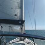
A screenshot of the tracker from the Pittwater to Surfers boys. In a light northerly, this is how you get up the coast staying out of the current!
Cheers,
SB

Select to expand quotetheselkie said..
Thanks guys. That is all very useful information.
Shaggy, that may explain the sea state a few years ago coming north. Was only blowing 20 SE, however, the waves were stacked up... especially just south of Coffs.
Speaking of Coffs, I'm assuming people go outside the Solitary Islands group?
Thanks guys. And yes, Morning Bird, definitely talk in the New Year.
Not nessasrally, I allways sail to the east of split and south solitary islands and west of north solitary, but I have many time seen boats sail the coast line through there ?
Going north I went between split and south and inside north solitary. Coming south, I stayed well outside all of them.
Select to expand quoteshaggybaxter said..
Hi Selkie,
Regards Gary's question on how close and far to the beach do you tack?
A screenshot of the tracker from the Pittwater to Surfers boys. In a light northerly, this is how you get up the coast staying out of the current!
Cheers,
SB
Like the Surf to City on your boat a few years ago ![]()
Thanks Woko and EC31 for the feedback regarding traversing the Solitary Islands. I guess I was just being super prudent ![]()
Just received a great stack of charts plus Lucas plus The Admiralty List of Lights and Fog Signals I purchased off a guy on Gumtree. Have also downloaded Rob's Passage Planner. Exciting times![]()
Select to expand quotetheselkie said..
T
Speaking of Coffs, I'm assuming people go outside the Solitary Islands group?
Thanks guys. And yes, Morning Bird, definitely talk in the New Year.
No, stay inshore and use your plotter. I usually head straight north from Coffs around Mid-night to 3am depending on the high tide at Yamba.
No point in going outside the solitary's as it only adds miles and puts you out in the AEC.
Select to expand quotetheselkie said..shaggybaxter said..
Hi Selkie,
Regards Gary's question on how close and far to the beach do you tack?
A screenshot of the tracker from the Pittwater to Surfers boys. In a light northerly, this is how you get up the coast staying out of the current!
Cheers,
SB
Like the Surf to City on your boat a few years ago ![]()
Yep, bloody headlands!
The EAC is a fickle thing, it is at it's maximum in the early months of the year (IE: now!) and it weakens towards winter.
Select to expand quotegarymalmgren said..
Just out of curiosity, how close is close or relatively close?
2 miles? 5 miles?
The Windy site has the current very close to the coast.
gary
Close enough, in the right conditions, to literally chat to the surfers. And I do mean 'literally"' in the true sense.
Select to expand quoteChris 249 said..garymalmgren said..
Just out of curiosity, how close is close or relatively close?
2 miles? 5 miles?
The Windy site has the current very close to the coast.
gary
Close enough, in the right conditions, to literally chat to the surfers. And I do mean 'literally"' in the true sense.
Guess I'll be doing day hops ![]()
Copy and paste this into your search bar.
earth.nullschool.net/#current/ocean/surface/currents/orthographic=-207.58,-26.16,3000
Select to expand quoteChris 249 said..garymalmgren said..
Just out of curiosity, how close is close or relatively close?
2 miles? 5 miles?
The Windy site has the current very close to the coast.
gary
Close enough, in the right conditions, to literally chat to the surfers. And I do mean 'literally"' in the true sense.
That probley explains why we have regular groundings along the north NSW coast. ( Just a gentle reminder )
heading north as a rule I never go over 50 foot of water and never go outside an island
Just an observation over the last few years that the Southerly changes in summer are quite unreliable to travel North on, i mean the idea is to wait for the southerly change then sail up on thee back of it.
But I've noticed not much ofa tail to the Southerlys, meaning you might need to get out there sooner after actual front goes through rather than waiting days.
Select to expand quotewoko said..Chris 249 said..garymalmgren said..
Just out of curiosity, how close is close or relatively close?
2 miles? 5 miles?
The Windy site has the current very close to the coast.
gary
Close enough, in the right conditions, to literally chat to the surfers. And I do mean 'literally"' in the true sense.
That probley explains why we have regular groundings along the north NSW coast. ( Just a gentle reminder )
And fatigue....With the relatively long distances between anchorages on the North coast
Select to expand quotewoko said..Chris 249 said..garymalmgren said..
Just out of curiosity, how close is close or relatively close?
2 miles? 5 miles?
The Windy site has the current very close to the coast.
gary
Close enough, in the right conditions, to literally chat to the surfers. And I do mean 'literally"' in the true sense.
That probley explains why we have regular groundings along the north NSW coast. ( Just a gentle reminder )
There's not many groundings while racing north, are there? Look at the ones reported here, for example, and we see few if any instances involving boats racing.
Please note the "in the right conditions" proviso.
Select to expand quotefrant said..theselkie said..
Hi all
All things being equal, I should be bringing the new boat home to Brisbane in February so I'm trying to educate myself about the EAC.
I'm looking at these:
www.bom.gov.au/oceanography/forecasts/idyoc300.shtml?region=NSW&forecast=SSTCur#
oceancurrent.imos.org.au/product.php
To my inexperienced eye, the temperature and current patterns of each site look a little different.
Can anyone give me a quick lesson for dummies on how to best interpret this data please?
Thanks
Trace
Probably more important to look at tidal current (ebb North set and flood South set) and stay relatively close to shore out of EAC flows South with some eddies. Need to go out to the edge of the continental shelf if you want a sleigh ride South.
That's very interesting about the tides frant, I have not considered tides while transitting North or South on the NSW coast, after thinking about the tide for bars you don't get much of choice after that. But it would make a difference by choosing to cross bars at different states of the tide to get a lift along the coast too!
So if travelling North and crossinga bar at the top of the tide, you'd geta little lift from the ebb for the next 6 hours.
I really enjoyed sailing the Qld coast where tide consideration is just as important as wind consideration, you geta lot of free miles (and comfort) by considering the tides.
Select to expand quotefrant said..
Probably more important to look at tidal current (ebb North set and flood South set) and stay relatively close to shore out of EAC flows South with some eddies.
Tidal set out to sea on the NSW coast has little relevance to sailing the coast.
As Bluemoon said its more important to get the tides right [ie last of the flood] into NSW's barred ports.
But if you are in QLD, then is really important to consider the tidal flows!
Interesting topic, I wonder if this was what gave me a hard time heading back north from Jervis Bay in late December. The Northly was not that strong but the swell was steep and strong. On the tack out I was crashing off the swell occasionally, it would virtually stop me in my tracks, then on the inbound tack I was being rolled back to JB
It took me an eternity to get across Crook Haven bight, on the way down I was enjoying a kite run at 10 knots!
Same kind of issue sailing up from the Hacking to the Harbour, much more sea than what should have been for the wind, quite uncomfortable and frustrating.
cheers Richard
Select to expand quoteStockie said..
Interesting topic, I wonder if this was what gave me a hard time heading back north from Jervis Bay in late December. The Northly was not that strong but the swell was steep and strong. On the tack out I was crashing off the swell occasionally, it would virtually stop me in my tracks, then on the inbound tack I was being rolled back to JB
It took me an eternity to get across Crook Haven bight, on the way down I was enjoying a kite run at 10 knots!
Same kind of issue sailing up from the Hacking to the Harbour, much more sea than what should have been for the wind, quite uncomfortable and frustrating.
cheers Richard
The current can be quite strong right in against the cliffs North of JB and over the Banks just North of JB. Heading North from there you really need to put a tack in right to the beach. Particularly in Crookhaven Bight if the tide is running out the river. The tide sometimes is strong for several miles along the beach to the North. About 3 miles out where the currents meet is a very visible line.