Australian Government Bureau of Meteorology
Western Australia
Local Waters Forecast
Yanchep to Mandurah and Offshore to Rottnest Island
Issued at 11:30 am WDT on Friday 6 March 2009
Valid until midnight Sunday
Warnings
Strong Wind Warning issued.
Synoptic Situation
A trough lies inland and is moving east. A ridge of high pressure is developing
south of the state in the wake of the trough.
Forecasts:
Friday until midnight:
S'ly winds 10/15 knots increasing to S/SW 20/30 knots
during the afternoon, easing to 20/25 knots later in the evening. Seas to 1.0,
rising to 2.0m during the afternoon. Swell to 1.0m.
Swell at Cottesloe: to 0.1m.
ARGH!!!![]()
![]()
![]()
Looking at the graphs at 3.30pm, one green arrow in the right direction - but its at Rotto.
Looks like I will have to dust off the "Use in Emergency Only" eXite board and go to SB for southerly. Dont know when it will kick in, if at all as forecast?
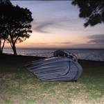
Sailed the ocean tonight at ![]() ******* not a wave in sight, but still enjoyed it immensely
******* not a wave in sight, but still enjoyed it immensely
Good luck Evets. Have you checked the graphs? Red arrows from the east![]()
Im going for the dawn sesh on the SUP![]()