i wonder who the 'they' is.
if it was local council, you'd expect some markings saying so.
and has anyone ever seen a sailboat on Boggy?
Boggy is private land, doubt it would be the council.
Prob some anal windsurfer that doesn't like sharing the water.
All to their own.
I doubt it was a windsurfer.....It is most likely the game reserve on the other side of the lake. They don't want moter boats (jet skis) The sign was made without kiters in mind.
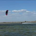
I hope kiting is still all go at boggy as I want to try it out for speed runs one day soon.![]()
legless might be right...quite some years ago they asked us to keep away from the far reed beds in the 'bay' because there were a lot of birds roosting with their young over there.
And Genetrix - i don't know how little wind or distance you need, but with the power turned on it's really hard to find good stretches without chop (i reckon Lake George spit is the best, just one hell of a drive).
however, the water level at Boggy is definitely dropping - if it continues you may just get a killer kite boarding speed strip.
au contraire my friend. the water is considerably lower at the moment in boggy than it was two week's ago - i think we enjoyed higher-than-can-be-expected conditions following recent flooding of the Murray river system, but now it's receding again. hopefully it levels out and does not lose any more, i don't want to go back to Boggy II.
The level looked low on the weekend because the strong northerly pushes all the water across the other side of the lake
tt is right we had the same here at lake george this morning, was sailing over weed beds that where up to the top of the water in the northerlys on the weekend but this morning we had a 30 knot southerly and it pushed all the water back and had a good foot over it. tt was on the speed gear on the weed bed just to the right of where you always camp was flat as in 30.![]() oh and trousers I was on a 5.0 race sail and it wasn't nuking.
oh and trousers I was on a 5.0 race sail and it wasn't nuking.
I don't think that sign was to exclude kiters. It was really I think directed to try and exclude motorised craft. Having said that the pro-fisherman is always doing his rounds, checking his nets out.
The water is still dead flat behind the reed banks in a Southerly. There's a channel on the Southern side of the reed banks, so a Northerly or Southerly works now.http://www.gpsteamchallenge.com/sailor_session/show?date=2011-04-16&team=22
Hi Trousers,
The water level was definately blown out by the northerly. It has always happened at Boggy. I think the water level will be good for sometime![]() .
.
See you soon.
Select to expand quote
That looks sweet as , cant wait to go down and check it out.
Any nasty bits in the water in the new speed channel?
There may be some "nasty bits" but I hav'nt seen anything to worry about thus far.
It is also shallow through this channel.
compared Peters tracks to 2009 nearmap photo and the run looks post/obstacle free, I could zoom right in and actually see the cracks in the clay.


Skillz Choco! You should work for DIGO.
Apparently there is a submerged fence post less than thirty metres from that southern shore that Norm (or more accurately his board) found this Summer. We don't know exactly where it is to tie a buoy to it, but by landmarks it's out from the tallest clump of trees/shrubs on that southern bay.
The Boggy regulars sail thru there plenty without incident, you'd need to be real unlucky to hit it.
i heard they were gonna fill it in altogether just to get the kooks into the ocean.
Trousers you could be right the water a boggy today had not blown back so it has dropped about half a meter. I hope we get a wet winter to fill it up again.
It's just come to my attention that a development plan exists for Boggy Lake. Closing date for submissions is this Thursday 09 June. You can download the plan on the Murray Bridge council website...
http://www.murraybridge.sa.gov.au/site/page.cfm?u=229
<moving this to a new thread>
________________________
www.boggylake.org