There is a big (possibly huge) weather event inbound. Models are jumping around a little with timing however next weekend or possibly mon/tues early march looks epic. Bearing in mind this is a medium range forecast..
Could be time to clean up the small kit and chuck a sickie or be on smoko


ECMWF latest track map has cyclone just off coast north of Bundaberg
(Charts will keep changing)

am tracking this pretty close so i can work out which days to take off work..... things are constantly changing so i won't post maps daily as they are likely to change but will say at this point that the ECMWF model is predicting the cyclone to arrive at the sunshine coast around wednesday 5th and JTWC is predicting something similar hugging the coast as it heads south. probably more likely it stays further north but who knows.
if either of those 2 outcomes end up happening that's a fairly rare event. think last time was early 90's
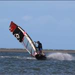
might want to hit golden beach and bar area while it still exists..... ![]()
Select to expand quoteJohn340 said..
Tides at Burrum look good from Thursday to Sunday.
Haha will blow mon then ![]()
Was down at Kingscliff from Friday till today, not much wind (pity because saturday was still ridable), but swell building the whole time, massive today, no one out in it in any shape or form, just huge close outs and walls of white water. I think GC is in for a real hammering. Stay safe.
I guess we will know by tonight if the westward track has started. Everywhere from Noosa to Gold Coast is in the direct firing line still although Caloundra is getting the focus of a most models at this time. Areas to the south will get the strongest winds and rain.

If you are into weather-watching as most of us are to some degree, a question is _why will it turn 135 deg to head west_ ?
Look at the world pressure maps...
zoom.earth/maps/pressure/#view=-28.3,151.9,4z/model=icon
There are two slow moving high-pressures in the Tasman Sea, the net effect will stop the southern movement in it tracks.
There isn't any real high-pressure over the centre of Australia, while there is a big high-pressure over northern New Zealand. Basically it will be sucked-westward and pushed-westward.
... that is my amateur's interpretation.
spot on matthew. cyclones don't steer themselves. they are steered by high pressure or upper level systems. the highs that steer cyclones westward are blocking highs.
some models i'm looking at are still suggesting a north brisbane or redlands / point lookout crossing.
anything is possible at this time. kinda hoping it just buggers off to New Zealand.
It's definitely coming, every model has it moving west, just a question of where and what latitude. And yes, if you're South of it, hunker down and put safety first! See you on the other side
The crossing time is predicted to be early in the morning. That coincides with the high tide. Golden Beach will be full of debris from Bribie is my prediction.
Latest track map from bom is back to showing Redcliffe crossing. looks like anywhere from Maroochydore to Tweed Heads is possible
Select to expand quoteGestalt said..
Latest track map from bom is back to showing Redcliffe crossing. looks like anywhere from Maroochydore to Tweed Heads is possible
It did a backward loop in the night. Gold Coast is looking more likely.
This slight delay could be good , to hit during low tide. But it changes every couple hours.