Forums > Windsurfing   New South Wales

Gerroa Report - Friday August 13

Reply
Created by stehsegler > 9 months ago, 13 Aug 2010
stehsegler
WA, 3549 posts
13 Aug 2010 8:58AM
Thumbs Up

Well someone turned up the swell up to 10 over night. It's pretty big and messy in the 4 meter range with bigger sets breaking out at the bomby.

Waves should start drop quickly though.

Wind in Gerroa is currently SW around 15 knts. and very gusty. There should be a bit more further north. Port Kembla or Windang would probably be the pick for today but get out early.

UPDATE (11:00 am):
Tide started running out. Size of breakers has definitely picked up. Size out at the bomby is now probably in the 6 meter range.

Wind is about 15 - 20 knts on the outside but only about 10-15 close to shore. Too light for my taste without a jet ski for support in case something goes wrong.


laff77
NSW, 273 posts
13 Aug 2010 11:48AM
Thumbs Up

Awesome photos! Those waves breaking out at the bomby are insane...

CJW
NSW, 1729 posts
13 Aug 2010 11:19PM
Thumbs Up

Days like these you need a jetski and some industrious/ballsy mates (to save your bacon). Drove past north beach in the Gong at lunch time at the bommie was PUMPING. Wind probably 30kts, easy 5m sets...looked wild. Anyone get out at Windang? Would have been on the sketchy side I imagine!
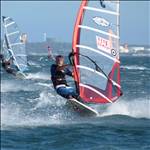
And man, The G looks messy

stehsegler
WA, 3549 posts
13 Aug 2010 11:12PM
Thumbs Up

CJW, totally agree. Werri Beach was monsterous this afternoon. Me (plus 25 odd people watched) some brave soul trying to make it out on a surf board.

He jumped off the rocks (Southern end) between sets and started paddling. It looked like he was really just a cork bopping around in the ocean. First it looked promising as the ripped started carrying him out past the break... only that it was followed by a big set of 5 meters plus waves that dragged him right back to where he started. We left after about 20 minutes. Man he must have been tired. The sad thing was that towing into that with a jetski would have been a piece of cake.

This really was just a repeat of last week Tuesday albeit with less wind and more sun. In retrospect I should have sailed the Northern end of seven mile last Tuesday. It looked scary with no one else around but was definitely do-able. Today was a whole different story.

Waiting4wind
NSW, 1871 posts
14 Aug 2010 10:03AM
Thumbs Up

Good stuff. Come summer we expect a regular weekend report with routine updates so we can jump in the car as soon the action starts. Time for a Twitter account!

CJW
NSW, 1729 posts
14 Aug 2010 10:45AM
Thumbs Up

Waiting4wind said...

Good stuff. Come summer we expect a regular weekend report with routine updates so we can jump in the car as soon the action starts. Time for a Twitter account!


That's what the shoalhaven heads surf cam is for I always check it before heading down, you can see if it's windy pretty easily. That said it's only a 30 min drive from the gong, I guess it's a different ballgame from Sydney or further afield when you might have to leave before the NE'r has kicked in.

stehsegler
WA, 3549 posts
15 Aug 2010 7:03AM
Thumbs Up

Waiting4wind said...

Good stuff. Come summer we expect a regular weekend report with routine updates so we can jump in the car as soon the action starts. Time for a Twitter account!


I already have something else in the works... Stay tuned...

stehsegler
WA, 3549 posts
15 Aug 2010 7:07AM
Thumbs Up

CJW said...
That's what the shoalhaven heads surf cam is for I always check it before heading down, you can see if it's windy pretty easily. That said it's only a 30 min drive from the gong, I guess it's a different ballgame from Sydney or further afield when you might have to leave before the NE'r has kicked in.


Yup... From Sydney you need to know by about 9:30 am to really make it worth the petrol. Plus there are days when it's actually better to sail in Sydney. Unfortunatelly neither the BOM forecasts nor the shoalhaven heads cam alone allow you to really make a good judgement call that early in the morning.

qwerty
NSW, 807 posts
15 Aug 2010 9:18AM
Thumbs Up

stehsegler said...

CJW said...
That's what the shoalhaven heads surf cam is for I always check it before heading down, you can see if it's windy pretty easily. That said it's only a 30 min drive from the gong, I guess it's a different ballgame from Sydney or further afield when you might have to leave before the NE'r has kicked in.


Plus there are days when it's actually better to sail in Sydney.


About as often as its better to go snowboarding in Noosa than in Perisher.

Waiting4wind
NSW, 1871 posts
15 Aug 2010 9:36AM
Thumbs Up

stehsegler said...

Waiting4wind said...

Good stuff. Come summer we expect a regular weekend report with routine updates so we can jump in the car as soon the action starts. Time for a Twitter account!


I already have something else in the works... Stay tuned...


A stehsegler cam....

stehsegler
WA, 3549 posts
15 Aug 2010 11:53AM
Thumbs Up


About as often as its better to go snowboarding in Noosa than in Perisher.


Whoooooot. They have snowboarding in Noosa?

But seriously. Especially in late summer there seem to be a few days were thunderstorms shut down the NEer anywhere south of Cronulla.

Ian K
WA, 4157 posts
15 Aug 2010 12:31PM
Thumbs Up

I suppose it makes sense that a thunderstorms are more likely to form in places where the Noreasters are strongest. They are related. But it seems to me , when looking at the seabreeze chart when you get home, that if you wait an hour or so the noreaster at Gerroa can come back after being turned off by a thunderstorm.

bdl2333
NSW, 117 posts
15 Aug 2010 4:04PM
Thumbs Up

yep sign me up for the daily Stehsegler Gerroa report. does it come complete with signed doctor's certificate to hand to the boss the day after a decent session?

CJW
NSW, 1729 posts
16 Aug 2010 7:25PM
Thumbs Up

Another thing to note RE picking the NE'r at Gerroa are the wind readings from Point Perpendicular. If you watch it in the morning there it's almost always NE <12kts ish. By mid morning it will start to drift towards NNE and then you know it's on. When it hits 12-16kts NNE at Point perpendicular you can be assured it's 20kts+ NE at Gerroa. I have no idea why, i'm not sure where the P.P wind tower is, or it's surrounding topography but i've been watching it for many years and it's always the same. When it hits 18-23kts NNE at PP you know it's >30 kts at Gerroa.

bdl2333
NSW, 117 posts
16 Aug 2010 9:17PM
Thumbs Up

CJW said...

Another thing to note RE picking the NE'r at Gerroa are the wind readings from Point Perpendicular. If you watch it in the morning there it's almost always NE <12kts ish. By mid morning it will start to drift towards NNE and then you know it's on. When it hits 12-16kts NNE at Point perpendicular you can be assured it's 20kts+ NE at Gerroa.


thanks for the tip CJW. hopefully be checking that a lot this summer . How do you guys think Wednesday is shaping up for a Gerroa session?

stehsegler
WA, 3549 posts
17 Aug 2010 9:14AM
Thumbs Up

I wouldn't hold my breath re Wednesday. From what I have seen over the past two months a full on Northerly most of the time doesn't get into the basin properly... I think it has to do with the topography of the surrounding area. In a nutshell the range around Saddleback mountain simply blocks it.

That said I need to check Shoalhaven Heads... possible it gets in down there.
...either way, I'll let you know what it situation is first thing tomorrow morning.

qwerty
NSW, 807 posts
17 Aug 2010 12:37PM
Thumbs Up

Just sail in the Gong (East Corrimal, Warilla).
NE'rs are usually just as strong, if not stronger than Gerroa until around late Oct/early Nov when the weather really heats up.

Having said that, banking on a NE'r anywhere in August doesn't always pay off.


Subscribe
Reply

Forums > Windsurfing   New South Wales


"Gerroa Report - Friday August 13" started by stehsegler