I was talking to a workmate today, and he said that you can download an application to your iPhone that will display all your trackpoints, as well as max speed, after a skiing session. It will also show you where you are on a satellite map!
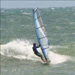
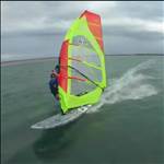
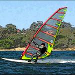
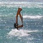
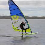
Sounds pretty cool to me, has anyone got any info on how accurate the iPhone is as a GPS? Anyone tried it for a windsurfing session?
I was thinking of people who have an iPhone but don't have a GPS yet, as a way of getting them addicted. "The first hit's free" or words to that effect. If it worked then it might be a way for people to get an understanding of how fast they go.
(It could also be a way for people to track their progress cycling, jogging etc...)
Hi Nebs,
Any idea what the Iphone application is?
I will run it with the GT-11 and see what happens, output etc.
Anything to get more people into the GTC ![]()
I also like the idea of being able to call the other half when I get stuck on the wrong side of the river and no wind ![]()
The Iphone lot are quite possessive and will probably want to take their baby with them anyway ![]()
I was thinking of building a storage area in my board to maintain a data centre.
Numerous cameras on the rig , board and me all linked to data centre.
Satellite and transmitter aerial attached to top of mast.
Data centre has GPS software etc. ,transmitter to base station, base station loads data to Website.
Webpage displays GPS track overlaid on map, speed and location, and all camera angles.
I call it the Netboard (Patent Pending)
Just kidding ![]()
![]()
How about for the busy executive if your netboard could be controlled via the web. Then you could send it to Maui and windsurf from the office! Cool!![]()
But wait there's more !!
Netboard robot:
This allows the Netboard rider to connect to their office/home network, and control other peripherals from Netboard.
"I'll be working from home" will have a whole new meaning
Netboard drone:
This remotely controlled board will allow the user to deploy the Netboard into any theatre of conflict. The Netboard can then carry out dangerous missions with the rider safe at home base. Additionally Netboard drone can take data from another Netboard to allow it to replicate the other Netboards journey. This will allow a riders with 2 Netboards to compete against themselves.
World of Netboard:
This is a Netboard online community used to conduct Netboard drone GPS trials.
Superusers know as the 'Elite' will have the ability to control numerous Netboard drones using Netboard robot, from the Netboard they are currently riding.
This will allow virtual and actual Netboards to compete in a World of Netboard GPS trial.
All Netboards will be certified 'Apple free', to ensure compliance with World of Netboard rule (XV11 para X)
I hope nobody calls me an old fashion technophobe, but I was thinking about taping a stopwatch to my boom and when you start windsurfing you push the start button and when you have covered the required distance you press the stop button, then you get off your board and take your calculator out of your aquapack, and you work out your speed based on the approximate distance you travelled divided by the time it took, and Whalla you have your speeds at the fraction of the cost of an iphone![]()
my sisters got an iphone and it has some pretty trippy features such as-
a pretend light sabre complete with the noise!
and a pretend glass of piss..umm beer that emptys as you tilt it towards your mouth!!!! what a load of crap!!!!....................ummm i still want one![]()
I just got a new blackberry - www.bbtracker.org/ - and no even if it could do it Im not getting it any wetter than it does when I ring the wife after / during sailing to say Im on the way home REALLY
A bit more clarification (I hope) on the issue of NMEA v's Locosys binary accuracy.
Locosys made some changes to the way NMEA was saved for us some time ago that improved the precision in the data, so with the GT-11 and GT-31 my understanding is that the NMEA Doppler data does have the same precision as the Binary data.
The point is that in other devices it is highly unlikely that the saved NMEA files will have that extra precision as most GPS manufacturers don't think it is nessasary. They are correct of course for use in car navigation programs etc, but for accurate speed measurement using the saved files we have a higher requirement.
The other significant advantage of the binary data, especially the compact .sbp format, is that it writes and read much faster so there is less chance of data being lost in the write process (we had a few reports of this happening occasionally with NMEA data). Because the files are much smaller it is also a big advantage for storage on the card and for archiving on your computer, and especially for sending via email.
So Roo is correct in what I think he was saying that in the GT-11 and GT-31 with the later firmware the precision NMEA v's Binary is the same. It remains highly likely that the NMEA data from other devices is 'rounded down' in the saving and will not be as precise.
The doppler data stored as NMEA or Binary are exactly the same and come from the same data source in the GPS which is the Speed Over Ground data (SOG). It doesn't matter what GPS you own, they all record it the same way to 2 decimal places ie 49.09 knots! It is one component of the velocity equation which also includes Course Over Ground (COG) which is also stored at the same level of precision as NMEA or Binary. As Daffy said the only real advantage of Binary over NMEA is a smaller file size. The reason data was lost was not due to the writing of the NMEA data but the writing of data to the SD card, either Binary or NMEA. The units only have limited computing power and they don't handle multi tasking as well as a desktop computer, best suggestion is to save data to the internal data logger and turn off all recording to the SD card ensuring all processing and battery power are devoted to the gps chipset. With this method you decrease the odds of getting corrupted data files on your sd card. At the end of your session you can save the data from the data logger to the sd card. I also prefer to turn off all filtering and further reduce the workload the gps is performing.
The Locosys units aren't the only ones that save binary data, all gps chipsets are capable of saving it, you just have to tweak them a bit to get them to give up their secrets! Some even do it at 10 hz.
To save any further confusion Daffy, what do you mean by "full precision"? The GT-11 saved SOG data to 2 decimal places right from day 1 when it wouldn't even work long enough to walk around the block and record a complete track! It drove me crazy trying to work out what was wrong with it, April 2006 if I remember correctly...seems a long time ago now I first looked at doppler speeds.
SOG saved to one decimal place. Perhaps I am wrong about the changes in the GT-11. Maybe I am thinking of the extra precision that was introduced for the trackpoint data.
Trackpoint data gained an extra decimal place when we started recording binary data, the NMEA standard doesn't have the space in the output message to store it that way. As it turned out it didn't really matter as the trackpoint data was never as accurate as the SOG doppler speed anyway. The only way the trackpoint data could be made more accurate was if it was post processed to correct it, that is why I introduced the binary data recording in the first place to get the extra data needed to do that. Any units that saves SOG to only one decimal place must be very rudimentary indeed, I've yet to come across any of these units but if I do I'll make a point not to buy one.
You are quite right about the GT-11 Roo. I looked at my earliest file and it does indeed have the speed to two decimal places in knots. Excerpt GT-11 - speed in knots bold:
$GPRMC,030003.136,A,3850.7607,S,14609.4178,E,5.71,344.67,170307,,*11
These Garmin files don't:
$GPRMC,002454,A,3553.5295,N,13938.6570,E,0.0,43.1,180704,7.1,W,A*3F
and another different model:
$GPRMC,152926,V,6027.8259,N,02225.6713,E,10.8,0.0,190806,5.9,E,S*22
I think there are plenty out there but not much use to us anyhow.
Bottom line. If you intend to use NMEA data from some other device, check to see if the sentences output/write the speed in knots to 2 decimal places.