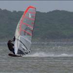
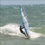
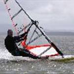
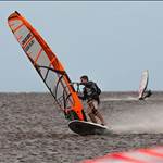
This photo is in one of the emails going around. Naturally when I saw this, I thought of going flat out on a windsurfer on the leeward side. Windsurfing, a terrible obsessive addiction

Where is it?
Three things strike me.
1. there are trees along the left side of the airstrip that wouild probably block the wind from the right
2. There is evidence of swell rolling in on the left side which indicated it is open to the ocean swell and therefore may not always be flat even in offshore winds.
3. It looks like a tropical Atoll so it may get trade winds but would they be strong enough for speed sailing and what is the prevailing angle?
Great photo!![]()
It looks like the small airstrip on Bora Bora or one of the even smaller islands like Maupiti or Tetiaroa.
There are some awesome flat water spots on the windward islands in French Polynesia.
Year round warm water and trades![]()
Found it:
Majuro Atoll - www.airliners.net/search
R,
H
EDIT: Google Maps link (I think this is the runway half obscured by cloud) maps.google.com.au/maps?f=q&source=s_q&hl=en&geocode=&q=Majuro+Atoll&sll=-25.335448,135.745076&sspn=70.452467,158.203125&ie=UTF8&ll=7.067717,171.282563&spn=0.019932,0.038624&t=h&z=15
Looks nice.
I just LURVE Google Earthing these places!![]()
Here is another view of the airport after an apparent upgrade:

Here area couple of nearby NM speed ponds, especially made by nature for speed sailing fanatics
(assuming that at some time of the year the trade winds blow in the right direction) ![]()
The line is 1 NM!

this one is 3NM!!!![]()

Ahh well, we can dream..........................![]()
Just look out for those white blotches... I'd imagine they'd bring you to a stop pretty quickly ![]()
![]()
not just the white blotches Nebs but just what lurks inside those atolls....I don't know if I'd be too confident dangling about in any of those for any length of time.
to the left of the airport on google is the "death pool". looked pretty nice to me!
I knew the yanks did some nuclear testing in the Marshall islands but this was pretty freaky:
"During the period from June 30, 1946, to August 18, 1958, the United States conducted 67 nuclear tests in the Marshall Islands, all of which were considered atmospheric. The most powerful of those tests was the "Bravo" shot, a 15 megaton device detonated on March 1, 1954, at Bikini atoll. That test alone was equivalent to 1,000 Hiroshima bombs.
While the Bravo test is well known, it should be acknowledged that 17 other tests in the Marshall Islands were in the megaton range and the total yield of the 67 tests was 108 megatons, the equivalent of more than 7,000 Hiroshima bombs.
For the sake of comparison, it may be noted that from 1945 to 1988, the U.S. conducted a total of 930 known nuclear tests with a combined yield estimated to be 174 megatons. Approximately 137 megatons of that total was detonated in the atmosphere. In other words, while the number of tests conducted in the Marshall Islands represents only about 14% of all U.S. tests, the yield of the tests in the Marshalls comprised nearly 80% of the atmospheric total detonated by the U.S."
windsurfing gear: check
booties: check
NBC suit: check![]()
kato wouldnt need his lights after sailing this place because he would GLOW in the dark![]()
For a place in the middle of nowhere there seems to be a hell of a lot of buildings and houses on such a small Island. Very densely populated. What is the place now? Is it a US military base of sorts?
Edit- just Wikipedia'd it. Interesting history. This is a bit alarming though.."The Marshall Islands has the highest rate of leprosy in the world"
Andrew the Wikkipedia site was quite interesting. Tourism is still the biggest industry. They tried setting up a Tuna factory but that went downhill. Copra apparently is the big saviour due to all the outer lying islands supplying them. Must have been a huge setback for the country when the airlines cut back flying there. You never know, threads like this might spark some interest in the place and it could become a bit of a hunt for windsurfers looking for another adventure or indeed could be an awesome natural speed spot.
Slowie surely you've got enough FF points saved up to go on a fact finding mission for all of us???!!!