Hmm. I always knew we were moving NNE at 7-10cm PA, but I guess I just assumed the maps for the Australian Grid system were continually updated. Obviously not, except I guess for Google Earth and other digital maps. So it is a bit hard to define your property boundaries using the Map datum and a GPS. ![]()
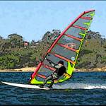
So if you do your speed runs in a nne direction on inland waters, you may get an unfair advantage ![]()
If we build a massive sail and plug it in the centre of Australia do you think we would crack 5knts?
This movement would explain the shift on Decrepit's tracks, compared to the streets on Google Earth when he tests GPS units on his bike