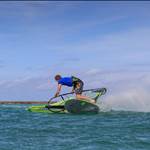
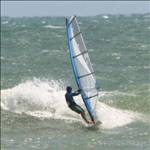
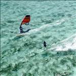
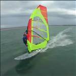
Can we have some practical advice on how to share the different types of GPS's please. Not every team member will have their own GPS, so how do we share, and know who's data is who's? What are the mechanisms to do this? Ta!!!!!!
sounds complicated... just like sharing of women. Who's DNA is whos?![]()
Not sure about the garmins but i think with the NAVI you could just swap SD cards.
Am one who will be sharing with other team member and with a NAVI (yet to arrive)so if its just a card swap, great, but any enlightenment would be good on this point.![]()
Mineral![]()
If you've got something other than a NAVI, I'd:
1) Turn the unit off and back on again when swapping sailors. This should make a new file, or at least make it easy to see where your sessions start and end.
2) Write down the time each sailor had the unit.
3) When a sailor gets the unit, that sailor should walk around in a certain pattern before sailing. So sailor 1 might walk round in a circle, sailor 2 might go in a triangle, sailor 3 might go in a cross pattern. When you look at the data you'll see a shape appear in the track so you know who's got the unit ![]()
quote:
3) When a sailor gets the unit, that sailor should walk around in a certain pattern before sailing. So sailor 1 might walk round in a circle, sailor 2 might go in a triangle, sailor 3 might go in a cross pattern. When you look at the data you'll see a shape appear in the track so you know who's got the unit
With the NAVi you can turn the logging off then back on, thus creating another file. You will have to keep note of the time tho so you know who's log is who's. The other way might be to insert a waypoint with the riders initials (and maybe a number for multiple turns) when you swap.
Probably the best way is to take a laptop and download the file between each session and then erase off the unit. You'll need a USB to a serial converter for the Foretrex/Garmins, can buy these in Officeworks and Tricky Dickies. Can't comment on the Navis ![]()
Not sure I like the idea of dripping salt water into a lap top, same goes for swapping SD cards. Means somebody has to stay dry.
You can record a waypoint at the time and place of sailor change over using for example the new sailor's name to ID the next data block. Next name (waypoint) is end of last user and start of new one.
Waypoints have their own short menu in most units, just follow the prompts. A few tests prior to sailing should sort it out for most users.
Roo or Mal W. may have a procedure in mind already.
i think if you use realspeed changing sailors won't be a big issue.
it is the easiest to allow edits of the uploaded tracks. as long as you keep an eye on who sailed for which time period you won't have any issues.
just open the track in RS. then delete all the tracks that aren't yours. then save as under your name and date.
then open original file and repeat process until everyone has their own tracks.
i find gpsar is a bit difficult to handle tracks when you need to edit them. but gpsar does NM mile so i use it for just that. (unless RS can do NM? then i will ditch gpsar)
quote:
Originally posted by Gestalt
i think if you use realspeed changing sailors won't be a big issue.
it is the easiest to allow edits of the uploaded tracks. as long as you keep an eye on who sailed for which time period you won't have any issues.
just open the track in RS. then delete all the tracks that aren't yours. then save as under your name and date.
then open original file and repeat process until everyone has their own tracks.
i find gpsar is a bit difficult to handle tracks when you need to edit them. but gpsar does NM mile so i use it for just that. (unless RS can do NM? then i will ditch gpsar)
sorry mineral, i've been hanging out with the nerds for too long. [}:)]![]() realspeed is mal wrights speed software. personally it rocks. it also deals with peaks etc so the results you get are almost perfect.
realspeed is mal wrights speed software. personally it rocks. it also deals with peaks etc so the results you get are almost perfect.
gpsar is what most use around the world. i find it difficult to edit the tracks but it has some awesome features like analyzing your race craft, map overlays and also playback of tracks.
oops, and NM means nautical mile. ![]() but i think it should be referrd to as bad back syndrome.
but i think it should be referrd to as bad back syndrome.
if you have the navi the best way is to simply turn the unit off then on again and it will start to write a new file which will be labeled with the precise time and date stamp at start up so just take note of what time you hand the unit to your mate. he/you will probably want to 'zero' all the readouts on the unit, but this is not all that critical as the file data is the important stuff .
with the garmin also note the time of unit hand over and then open the file in gps action replay and split the tracks at that time,then save both tracks... not sure if realspeed can split tracks but it is great for auto delete of spikes etc.
if the above fails just walk around in the shape of an 'L' ;)
'realspeed' should be able to do a nautical mile division just go to top menu and select 'add division' and fill in the boxes ie meters =1852 (nm)
and tick accumulation and give the div a name.