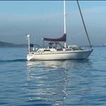
Nice video Mag, thanks for that. Nice bluewater boat too!
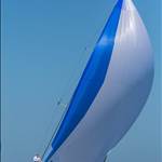
I'm not a fan of roller furlers in heavy winds, aside from the strain on the furling line and the resultant carnage if it lets go, it's the centre of effort is way higher when half furled. A storm jib will heel way less and points soo much better. But I get the convenience over comfort.
Glad the seas abated, the channel just North of Moreton is horrible, a veritable washing machine.
Beautiful video, the seas looked magnificent. Makes me all twitchy.
Two fundamental errors in decision making
firstly the plotter use and secondly not identifying the most dangerous issue
Sorry with all respects
However accept I have advantage of fishing and sailing that particular stretch since about 1975 but same issue on most of east coast
Select to expand quoteMAGNESIUM said..
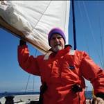
Smashed in 60 knots & 6m seas
Wish my wife was that capable!
The local Amel 54 is on it's way North to Queensland at the moment. Lovely big boats. They are absolutely identical boats world wide. Watching that video it's like being onboard the local boat.
Select to expand quotelydia said..
Two fundamental errors in decision making
firstly the plotter use and secondly not identifying the most dangerous issue
Sorry with all respects
However accept I have advantage of fishing and sailing that particular stretch since about 1975 but same issue on most of east coast
What's the second error. I think I would have stayed at sea and waited for it to blow over but very keen to learn from more experienced than me.
What was wrong with the plotter use as well.
Easy to be the lounge chair critic so will be careful.
The chart is full of current warnings along there and on a paper chart you would lay off a course accordingly and with precision.
only very high end plotters allow you a lay off a course properly.
The gap through Cape Moreton is huge and well lit. (They ended up well north and there was no need)
Or to put another way, when was the last time you laid off a course allowing for the leeway of your vessel in strong winds. (Experience tells me you will underestimate it by lots) Also here the course was cross current of over 2 knots for at least 24 hours so 50 miles directly upwind here.
The position line (to call it that incorrectly) on most plotters predicts your course ignoring all these things as the plotter in the video showed.
The weather model they had identified a short lived event so me personally, and not criticism, but why come over the 100 fathom line, just wait a bit.
This was actually quite dangerous.
Sea state even 10 miles outside it will be very different from 100 fathom to the beach because of the set which would have been over 2.5 knots heading south once you hit that.
also current becomes much less uniform inside the line so when set against wind seas are much more confused. (Why you never sail over a sea mount in a gale, same as never come in over the 100 fathom line)
Slowing the boat even 6 hours before there would mean you got there and the wind had already dropped in the video by then.
There is a good explanation in Guzzwells book where he sits out a cyclone just off Cape Moreton and ends up off Yamba.
Also an article by the Pardleys about getting caught in the set a bit further north. (Described by them as worst seas ever encountered)
Just out of interest my local VMR where I volunteer has rescue responsibility for that area and 50 miles to sea.
Also when i first went out there in the 1970s, Roberts Shoal had an unlit bell buoy on it and Mooloolaba Yacht club had a night race down to it and return.
Select to expand quotelydia said..
Easy to be the lounge chair critic so will be careful.
The chart is full of current warnings along there and on a paper chart you would lay off a course accordingly and with precision.
only very high end plotters allow you a lay off a course properly.
The gap through Cape Moreton is huge and well lit. (They ended up well north and there was no need)
Or to put another way, when was the last time you laid off a course allowing for the leeway of your vessel in strong winds. (Experience tells me you will underestimate it by lots) Also here the course was cross current of over 2 knots for at least 24 hours so 50 miles directly upwind here.
The position line (to call it that incorrectly) on most plotters predicts your course ignoring all these things as the plotter in the video showed.
The weather model they had identified a short lived event so me personally, and not criticism, but why come over the 100 fathom line, just wait a bit.
This was actually quite dangerous.
Sea state even 10 miles outside it will be very different from 100 fathom to the beach because of the set which would have been over 2.5 knots heading south once you hit that.
also current becomes much less uniform inside the line so when set against wind seas are much more confused. (Why you never sail over a sea mount in a gale, same as never come in over the 100 fathom line)
Slowing the boat even 6 hours before there would mean you got there and the wind had already dropped in the video by then.
There is a good explanation in Guzzwells book where he sits out a cyclone just off Cape Moreton and ends up off Yamba.
Also an article by the Pardleys about getting caught in the set a bit further north. (Described by them as worst seas ever encountered)
Just out of interest my local VMR where I volunteer has rescue responsibility for that area and 50 miles to sea.
Also when i first went out there in the 1970s, Roberts Shoal had an unlit bell buoy on it and Mooloolaba Yacht club had a night race down to it and return.
Thank you for taking the time to share that.
Fantastic description Lydia , tho surprised you picked up on the duration of the blow.
having sailed that area in a lot less wind It terrifies me , and the prospect of heading into further hell up north my thoughts would be staying out in the lovely deep water.
also being aware of the Pardey's words on the seas they encountered in their storm would have been in the forefront of my mind.
this yacht has a 100hp engine and only guessing here but they may have put a lot of faith in it.
not being out there I can only imagine they stepped into hell and survived.
i was lucky enough to be towed across Morton Bay in a 30kt blow by you guys and watched as your boat disappeared as the waves went over it, I sat in the cockpit and was drowned as you guys watched me cop it.
i hope to never be in that area EVER in 60kts
I really like the videos - they are real people, without the wagglings boobs and bums that some use, and are quietly competent, but still stuff up a little - like me.
At the end of the video they talk of being sick (with Flu or Covid) and making bad choices. I think that is a really good point to remember. They also say that they should have altered course earlier and changed clearance port to Bundy. Coming from the north of Noumea (after leaving Port Vila they went around the top of Noumea) the trip to Bundy would have been a bit shorter, with a better angle and also they would have had the shelter of Fraser much earlier.
Maybe we should have a passage set of notes with guidelines that you set up beforehand so that you don't try and talk yourself into seeing or believing what you want to believe. I think that if they had a rule that said "We can head for Brisbane but if we have a forecast for over 40 knots two days out (they did) then we head for Bundy". Then you have to make a reasoned explanation as to why you are not following protocol. So a lesson learnt for me, by someone else. I haven't done much bluewater stuff but do remember crossing the 100 fathom line 30 years ago off Moreton - the waves were pretty awful as we crossed it. On my trimaran we broached slowly (which had never happened before) and my friend on the windward side of the cockpit fell onto me to leeward - not a thing that should happen on a multi - but we shook it off and plodded on - but the call of shelter is hard to resist. Still, they could have sheltered in Platypus Bay probably about 12 hours earlier if they had been cleverer than they were.
I hope the makers of the video do not take anything i say as criticism but thank you for your kind comments M.
just taking up a point Kankana raises, years ago sailing with Mounsey, he would take about "decision points" (think that was what he called them, bit like a line of departure in military operations)
No gps back then and you might not get a reliable fix for a few days so relying on DR.
So set a point after which you can not be sure of your position or weather and after which you are committed to sailing in to the unknown without accuracy or good information.
Never pass a decision point without setting a new one if you are happy to do so.
So if you are relying on DR and you are closing a leeward coast, back off until you get a reliable position for instance.
Bad information means bad decisions.
it would have been interesting to see the barometer plot in the video, as that would have been very helpful with a small intense system in setting a decision point.
We have such amazing technology now but it disguises the lack of basic skills
In my first ever course I did in navigation when about 15, i did it at TAFE with the prawn trawler skippers who had to then get actual qualifications.
The instructor Norm Wright Jnr knew his audience, on the chart from Cape Moreton to Breaksea the thin edge of a match box reflected 2 knots of set so Norm taught them all how to lay of a course by rolling a match box across the chart.
And everyone had that essential navigation tool back then.
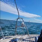
That certainly changed my opinion of a fully enclosed cockpit.
Shelter From The Storm.
gary
Yeah but if you didn't have the shed you would have been able to make emough soeed to get out of the bad weather. I liked Fatty Goodlander's take on his Endurance 35. It was a great boat on long passages he said - it had to be because it was so slow that every sail was a long passage. That being said, the new IMOCAs and ULTIMEs have totally protected cockpits too so the best way would be have a low windage shed.
60 knots???? Hmmmm. We know that film makes conditions look better but there also seems to be a special anerometer that comes with Youtube videos. In 60 knots "the sea is covered with long white patches of foam; everywhere the edges of the wave crests are blown into foam; visibility affected" according to the Beaufort scale.

Richard Bennett pic, apparently a bit above 60 but also with a sea looking completely different. It's not an occasional crest breaking -it's "everywhere" the crests are blown into foam.
I've spent a fair bit of time around there under storm trysail and can't recall ever seeing a real 60 knots or anything remotely close to it. We were under storm trysail only when the owners of Sunstone - 7 or 9 times class winner in the Fastnet, winners of the top awards from the Cruising Club of America and Royal Cruising Club, Hobart class winner, liveaboards for about 32 years and people who cruised Alaska and Cape Horn for fun - met the worst seas in their experience about 10 miles away or less, and even then it wasn't close to 60 knots.
My favourite 60 knots story is from HMS Sheffield, one of the most active ships of the Royal Navy in WW2 and a veteran of the convoys through the Arctic Ocean to Russia. A 10,000 ton Town class cruiser, near sister to HMS Belfast which is a museum ship in London, she met Force 11 (about 60 knots) near Iceland in 1943. The seas were said to be level with the bridge, 78ft above sea level.
She was taking green seas until the sides of the front gun turret - 1 to 2 inches of armour plate, not normal steel - were squeezed in and a half to one third of the turret roof - 1 3/4inches of armour plate - popped off and went over the side. There's photos of the damage but I can't find them at the moment. That's 60 knots.
Select to expand quoteChris 249 said..
60 knots???? Hmmmm. We know that film makes conditions look better but there also seems to be a special anerometer that comes with Youtube videos. In 60 knots "the sea is covered with long white patches of foam; everywhere the edges of the wave crests are blown into foam; visibility affected" according to the Beaufort scale.
Richard Bennett pic, apparently a bit above 60 but also with a sea looking completely different. It's not an occasional crest breaking -it's "everywhere" the crests are blown into foam.
I've spent a fair bit of time around there under storm trysail and can't recall ever seeing a real 60 knots or anything remotely close to it. We were under storm trysail only when the owners of Sunstone - 7 or 9 times class winner in the Fastnet, winners of the top awards from the Cruising Club of America and Royal Cruising Club, Hobart class winner, liveaboards for about 32 years and people who cruised Alaska and Cape Horn for fun - met the worst seas in their experience about 10 miles away or less, and even then it wasn't close to 60 knots.
My favourite 60 knots story is from HMS Sheffield, one of the most active ships of the Royal Navy in WW2 and a veteran of the convoys through the Arctic Ocean to Russia. A 10,000 ton Town class cruiser, near sister to HMS Belfast which is a museum ship in London, she met Force 11 (about 60 knots) near Iceland in 1943. The seas were said to be level with the bridge, 78ft above sea level.
She was taking green seas until the sides of the front gun turret - 1 to 2 inches of armour plate, not normal steel - were squeezed in and a half to one third of the turret roof - 1 3/4inches of armour plate - popped off and went over the side. There's photos of the damage but I can't find them at the moment. That's 60 knots.
I would give them the benefit of the doubt, they talk about gusting 50knts in the day time footage you can see. In the comments they said the peak of the storm was at night when it was gusting 60knts (not a solid 60). 13 minutes in they say its 50 knots and 7/8 mtr seas, that's probably not the average wave height or a solid 50 but I wouldn't mind betting some big gusts and big sets were rolling through. I have some footage of 5mtr seas, gusting 40knts I was in and it looks significantly less intense.
Yep, but I just wonder sometimes since so many people on YT and other places overstate the breeze so much and so often that they and others may get a false sense of security if they ever hit the real stuff.
As an example I have a friend who avidly watched YT cruising vids. He's a very good dinghy sailor with plenty of day offshore cruising experience. So when he headed across Bass Strait he felt safe with a roller furling jib and standard mainsail. When I heard what sails he had I mailed him down my storm trysail but it went to the wrong address so he left without it.
That mate ended up hitting the Mayday button when he found that a roller furled jib and standard-reefed main don't cut it in real winds. He got towned in from about 40 miles offshore.
Another mate with a similar background did the same trip on a boat of the same size, also singlehanded. Last radio report was that his sails had blown. They found the boat- but not him.
It's fairly well accepted that in a real blow even standard storm sails are on the edge of being too big - or over the edge. Implying that a standard roller furled sail will get you through a real blow may be a dis-service to other people. Having lost one guy I know, and getting the call from Canberra about how my mate would be able to handle the conditions after he activated the EPIRB, I think it's fair to let people know that in a real 60 knots -and a real 50 or less - they need real storm sails or they may get into very real trouble.
Whatever the prevailng wind strenght is one can set the approriate amount of sail to cope with it. The gusts is where the problems and gear failures happen. Forty knot winds with gusts to 60 knots is a frightening scenario.
There is an amazing amount of information publicly available now about sea conditions.
Relevant to this thread search "Brisbane Wave monitoring" for instance.
Select to expand quotelydia said..

All cruising boats should have a shed!
Something like this?
yachthub.com/list/boats-for-sale/used/power-boats/adams-36/304326
Frankly it would be pretty boring out there under 60 knots. I wait for a gale warning then rig up my de Havilland Marine Gipsy & set out from my base under the spillway at Somerset dam. I time my arrival at Cape Moreton so that I can reach back & forth across the Northerly & watch the set crash into the cliffs. After a suitable time I head downwind via the outside crossing back in at South Passage where I spear a dugong for the family & head home up the river stopping at Breakfast Creek Hotel to spike the keg at midday.
Do they say in this Video when the storm occurred ? It would be interesting to look at some historical data.