just wondering with all the cruisers here, who seriously plots their path every hour using dividers, ruler , pencil and chart. Honestly. I'm thinking with GPS and chart plotters why most people would bother.
i know it's important when you are out Bluewater, but coastal cruising?
Maate!! You ain't got your logical thinking cap on.
When you are out in the deep blue briney, how many hard things are there to hit (apart from other things that float like container ships and containers that fall off them) ?? Very few.
How many hard things are there to hit that you know the location of from your chart when you are coastal cruising?? Plenty.
Therefore it is logical to keep closer tabs on where you actually are when coastal cruising than out in the big blue briney.
Bit of music to gel your mind. ![]()
Cisco, you already brightened up my day! ![]()
Steve, it is called piloting, if you are within sight of land, and it is not only a must, but an excellent way of passing time.
The use of the charts and plotting your position is not only necessary but also mentally challenging. The following of your path with a hand held compass or sextant hones your skills of the use of your equipment and by identifying land marks. By night it helps to learn the lights.
I personally find helming a yacht mind numbingly boring after a short while henceforth l employ the auto pilot and go 'exploring' with binocular and may be camera in hand.
To measure my progress, the leeway, the current all that with a hand held compass and trigonometry is a challenge to my exploring mind while MR chanel 16 on the VHF is being monitored in the background and some favorite playing on the stereo.![]()
Good replies so far & I agree.
If you want to be lazy, the absolute minimum you could get away with is looking at the paper charts(with your actual eyes!) before you set off to identify any hazards, then when in those vicinitys, plot your position then from a gps.
Steve, I think your in the Sydney region??...get yourself a copy of the Crawfords-Jervis Bay to Port Stephans chart book, $80 brand new, but worth every cent if you don't want to carry full sized charts. Don't know if this book satisfies the requirement to carry paper charts, but its what ive started using instead of full-size charts.
Select to expand quoteSectorsteve said..
just wondering with all the cruisers here, who seriously plots their path every hour using dividers, ruler , pencil and chart. Honestly. I'm thinking with GPS and chart plotters why most people would bother.
i know it's important when you are out Bluewater, but coastal cruising?
I use a laptop and Seaclear with Admiralty charts but it pays to keep a hard copy of recent events. Photo copy a4 sheets of the chart and place in a folder and annotate as you go. Just write notes on the sheets, time and lat and long every 30 minutes or so or "Just abeam Warden head light 2 miles"etc. Other points of interest like speed through the water wind details etc. Use in the cockpit on your knee.
Later you can look back and make adjustments for later cruises. Just keep a good look out for amateur fishing boats.
My thoughts. The reality of it is that electronic/gps chart systems are very reliable these days and paper charts are not a guarantee for not running aground. It's easy to get updates for electronic charts than paper and paper charts are not cheap compared to the electronic charts. Use to be the other way around in the past. If you're using your electronic GPS to transfer position points to paper charts then you are not a purest anyway. And this defeats the argument of reliability. I'm not saying to not use paper charts to record the progress (or keep a position log) of your trip or your intended course but when doing costal navigation the electronic charts seems to satisfy my requirements. I still don't trust the little buggers much when entering water ways in remote locations.
Now before you hit the "Reply to Topic" I also have paper charts for where ever I go, be it the Aussie charts or Billingham. I also pull out the paper chart when planning trips as I get a better feel for the planned voyage as well as what prevailing winds will do to the planned course. I also find paper charts interesting to look at, can't beat the big picture (with all the detail) laid out in front of you and not trying to do it through a 6" or 8" window. I still remember the first time (years ago) I looked at the chart that encompasses the East Coast of Australia and West of New Zealand. It's a work of art and wonder. Seeing seamounts and reefs I never new about. It sure helps when planning a trip to know whats out there and what may be in the way if you need to do a course change due to bad weather.
So SectorSteve, for me, paper charts are not an 'essential item' in coastal cruising these days but I still use them to a degree. But not like it was 30 years back when a line was drawn on the chart, and a magnetic heading determined before hoisting the anchor. Hand bearing sights were then taken on a regular basis to determine our position and any required course alterations. It took me a while to become confident (trust) in electronic charts (everyone was sure the big GPS switch would be turned off at some inconvenient time) after having so much faith in paper charts in the past. Just don't put all your eggs in one basket.![]()
Scary for me - I've met some yachties out there who don't ever look at their compass any more or use a hull mounted log because it fouled a long time ago, but seem to rely 100% on the GPS Charts. My compass died a while back and it was like having my right arm cut off until it's replacement arrived.
Problem is with the electronic charts is that if you don't zoom right in you can miss things. Things like reefs and rocks that are not nice to run into. It is prudent to check the paper charts where all details are visible!
(Learn't from experience. So glad I have a full keel steel boat!)
Great replies everyone, thank you. I'm def gonna grab a copy of that book blue moon, sounds great. I agree with all and crusoe you're so right . Paper charts are a work of art. They're a marvel to study. Always loved mapsand a atlas's.
i worked on a travelling private yacht for a number of years and we had to plot the course on the paper chart every hour, and record some info like the barometer into a logbook .
only reason I ask is that, I was just curious whether many people still navigate this way.
ive only done 1 trip outside from broken bay to port Jackson. I had paper chart, but I found , knowing the coastline there really well, I just used navionics mostly.
on Friday I will head down to Wollongong via bundeena, and like the trip from broken bay I study the coastline hard on Google earth, navionics and plot the route using navionics.
im pretty safety conscious and nervous, the same as the broken bay trip but excited as well. today I'll have a secure cockpit with new staunchon and wire As my boat has no lifelines. She'll still have no lifelines but the cockpit should feel more secure. Hope the weather stays good.
Select to expand quoteSectorsteve said..
ive only done 1 trip outside from broken bay to port Jackson. I had paper chart, but I found , knowing the coastline there really well, I just used navionics mostly.
They say there are those that have, and those that haven't.....yet......
i fall all into the category of those that have, and it was In an area I was suppose to know well. To be honest, in my case, I don't think a chart or GPS would've made a difference though.
The old school reluctance on the GPS was because of something called selective availability on the USA sat system. They were able to reduce the accuracy of the GPS or even as said above, turned off completely. We use a European system know, and selective availability is no longer an issue. I am a big advocate of using paper charts for planning, but I see no issue or accuracy problems with updating your paper chart with lat and longs derived from the GPS. It would give you a far better staring point if things went blank then DR plots the entire way.
Well I just spent the last couple of hours plotting my course from Yamba to the Seaway on paper charts!
Once I had read all the guides and identified the hazards etc I plotted my waypoints and THEN transferred them to my Chartplotter.
I will have the charts out during the voyage too.
Only way to go!
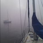
From Iluka Bay on SEAKA.![]()
Good stuff! Im all earsNAND digging this thread as most of you do this stuff often.
whT happened toph???
Select to expand quoteToph said..
They say there are those that have, and those that haven't.....yet......
i fall all into the category of those that have, and it was In an area I was suppose to know well. To be honest, in my case, I don't think a chart or GPS would've made a difference though.
The old school reluctance on the GPS was because of something called selective availability on the USA sat system. They were able to reduce the accuracy of the GPS or even as said above, turned off completely. We use a European system know, and selective availability is no longer an issue. I am a big advocate of using paper charts for planning, but I see no issue or accuracy problems with updating your paper chart with lat and longs derived from the GPS. It would give you a far better staring point if things went blank then DR plots the entire way.
Selective availability was always an issue, especially during a a major rocket launch at Cape Caneveral when the system went so haywire to be totally useless.
It should always be kept in the back of your mind that GPS and even the Russian Glonass system are owned and operated by their respective governments and as such can have Selective availability turned on again at any time or even have the entire system switched off altogether .......... and then you can say "where the Fugawi?"
Select to expand quotesurfershaneA said..
Problem is with the electronic charts is that if you don't zoom right in you can miss things. Things like reefs and rocks that are not nice to run into. It is prudent to check the paper charts where all details are visible!
(Learn't from experience. So glad I have a full keel steel boat!)
This only applies to navionics style electronic navigation. Seaclear the detail is always there no matter what the zoom.
It is good seamanship to utilise your charts to plot your journey and keep watch at all times. Keeping photocopied charts on board does not cover the legal requirements.
What is wrong with using the charts, marking them with a soft 2B pencil then using an eraser? They have to be updated regularly.
Boat Books in Crows Nest is doing it $3.75 a pop. If there are too many changes, you by a new chart.
One should use his chart plotter as a back up tool.
Piloting by sextant or hand held compass is not a must this days but it is also good seamanship and fun. Then you check it on the plotter for correctness.
Keeping MR on the VHF on channel 16 monitored while underway is also necessary.
If you sail single handed or on watch at night alone always use a harness and clip yourself on the jack line when you working on the fore deck.
Steve looking at the wind predictions for Friday l would start the day checking my reefing gear! Fair winds!

![]()
I have a sextant and an Ocean Nav qualification but never use it. Too difficult and expensive to get and keep up to date Norries, almanacs etc. The main source of navigation mistakes is misplotting positions. The chart plotter removes this as a risk. I was a slow convert but I now use the chart plotter as a primary nav and the chart as secondary. I put a fix on the chart every hour inshore and every 3 hours when more than 10nm off shore.
Actually the plasticized copies from chandlers or MSB are perfectly legal. My photo copy of a section of 808 mounted in a picture frame on the bulkhead passed the annual survey for years!
Yeah, l understand the trend, my yacht has two separate GPS's. The older one below mounted on the chart table the other mounted on the cockpit bulkhead. Makes it easy plotting your course next to the charts.
Add the phones and there are at least three GPS's aboard, as long as they are working.
As long as we got electricity to make them work and the system itself is turned on and working correctly hence the comments about the possibility having them turned off at the wim of some warmonger or psycho.
Whoever, keeping the charts is a vise move and not losing the old skills in trigonometry and using just the hand held compass let alone a sextant could help you in a jam.

![]()
Select to expand quoteSectorsteve said..
Good stuff! Im all earsNAND digging this thread as most of you do this stuff often.
whT happened toph???
Nothing too exciting SS, just a bit embarrassing. I nicked a bommie in a bay that I thought I new well. That on it's own wouldn't of been too bad. It was a southerly blowing that pinned me on the bommie that caused the damage. The point being, that I learnt the hard way not to relax too early or become complacent in a well known area.Select to expand quoteLooseChange said..
Selective availability was always an issue, especially during a a major rocket launch at Cape Caneveral when the system went so haywire to be totally useless.
It should always be kept in the back of your mind that GPS and even the Russian Glonass system are owned and operated by their respective governments and as such can have Selective availability turned on again at any time or even have the entire system switched off altogether .......... and then you can say "where the Fugawi?"
Hi LC, way too much relies on GPS as a primary means of navigation these days. Personally, I don't see (but never say never) SA being switched back on. I think the Yanks now just 'downgrade' the accuracy in regions of conflict.
Sure, scrary how some yochtees do move from place to place. ..seamanship new approach...
My compass is last 6 months in the bottom shelf, I always look around, see the distant coast line,
and island. If one of them is too close for comfort, I get below to consult the plotter.
Suprise, surprise what plotter show is very different what I see around.
Confused, well let's do half way.
Still have a keel intact, maybe just..
by the way, you mentioned charts, not compulsory in QLD any more
Charts are like common sense, decency and courtesy.
Not compulsory at all but still necessary and nice to have!
Cheers!

![]()
www.independent.co.uk/news/world/americas/sailor-survives-66-days-lost-at-sea-by-eating-raw-fish-and-collecting-rainwater-10153817.html
This guy didn't know where he was, all his electronics went AWOL perhaps if he had dragged out his sextant and paper charts they might have found him sooner, although the report said his boat had capsized I saw elsewhere that he had access to all his drinking water which he rationed to a pint a day, had he lost his mast surely his keel would have righted him.
I don't know all the facts as I wasn't there?
A sextant is useless outside sight of land without the books and tables to go with it. A chart with a mark on it occasionally is a must but in his case it would appear he had no means to sail or communicate anyway.
A Christian magazine article said the boat did right itself but lost its mast and communications (VHF aerial). The article said it was an Arlberg designed timber yacht, a pretty well regarded vessel.
It will be interesting to see how this pans out. Might be a publicity stunt.
You are correct Morningbird a sextant on it's own would be worse than useless without the gear to go with it, I assumed that if you took a sextant to sea the gear to go with it would be a given.
I think the media has doctored this story, be interesting to hear the full report.
Select to expand quotePropwalk said..
I think the media has doctored this story, be interesting to hear the full report.
The Media wouldn't know how to doctor a story of this type so they just make stuff up that sounds impressive and will fool their many sheep readers into believing that's what actually happened.
Select to expand quotePropwalk said..
You are correct Morningbird a sextant on it's own would be worse than useless without the gear to go with it, I assumed that if you took a sextant to sea the gear to go with it would be a given.
I think the media has doctored this story, be interesting to hear the full report.
Soggy tables and charts made from blotting paper are not much use The idea is to keep the water on the outside.
Select to expand quoteMorningBird said..
A sextant is useless outside sight of land without the books and tables to go with it. A chart with a mark on it occasionally is a must but in his case it would appear he had no means to sail or communicate anyway.
A Christian magazine article said the boat did right itself but lost its mast and communications (VHF aerial). The article said it was an Arlberg designed timber yacht, a pretty well regarded vessel.
It will be interesting to see how this pans out. Might be a publicity stunt.
In regard to the first sentence one also has to say a sextant is a very usefull tool to have aboard when inshore cruising. ![]()
It is Cisco, in theory and promoted in many older coastal nav texts. Usually to get a range off a known height such as a lighthouse. But there are numerous other aids that are easier to use. Using a sextant on a bouncy yacht is an art form of physical dexterity. If practiced regularly you can get a degree of expertise. Used without recent practice it is hard to get any accuracy.
A sextant can be used to accurately measure realitive bearings between identified landmarks, which if indexed to a compass bearing, course or DR line of position will result in a fairly accurate position fix. The fix is all important.
A sextant can also be used to calculate a range from a known identified height landmark.![]() I don't do much of this stuff but I do understand the principles of trigonometry as anyone who has completed high school should.
I don't do much of this stuff but I do understand the principles of trigonometry as anyone who has completed high school should.
Navigation is mostly about trigonometry and knowing that True Virgins Make Dull Company.
Battery is running low so gotta go.
You are right Cisco, theoretically.
Try using a sextant on a yacht to get any of those bearings accurately. Especially those requiring the thing to be held horizontally. Hard enough on a destroyers deck. On a yacht much regular practice is needed to get anywhere near a usable fix. A hand bearing compass is difficult to use but much easier for getting a bearing.
I would like to add to this worthy discussion that, though a sextant is indeed very difficult to use - most of our forebearers like Hiscock, Moitessier, Slocum just to name a few, used it quite successfully to circumnavigate the globe.
Also, the sextant is not utterly useless in case all the books are gone.
lt is still quite useful to establish ones latitude if one has a watch and sight of the sun!
Similarly, if one has a classical watch and is able to correct it to real time (no day-light-saving here!), could in seconds establish the north-south direction. The Southern Cross would serve the same purpose at night, giving away the position of the south pole.
To add, if one has a clear sky and knowledge of the heavenly bodies one would be able to establish his position quite accurately - as the ancient mariners did for thousands of years before compass or sextant - and navigate accordingly.
Steven Thomas's book ' The Last Navigator' is written on this subject.
We are losing ancient as well as recently acquired skills because of modern technology, and l find this extremely disheartening. We are forgetting to look around or up anymore, looking down at the screen as the only fountain of knowledge, entertainment, everything.![]()