Have not been yet ..
but some of Ben crops movies are quite good.. Barefoot captain on you tube
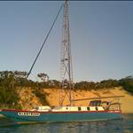
Was just talking about this trip Yesterday , I m thinking of doing it next year , just have to work out the logistics
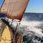
I ll be sailing out and fishing the area in tenders .
Yes I am thinking about it this year.
looks like quite the adventure,and realistically not that far.
Have not been there but mates who have all talk about the amount of a current particularly the eastern side.
6.2 Cato Island (23 ?15'S., 155 ?32'E.) is a small oval- shaped island and lies about 152 miles NE of Sandy Cape. The island is 5.8m high and formed of coral grit. An automatic weather station, with two radio masts and a silver-painted hut, stand on the NE end of the island. The island is almost entirely surrounded by reefs. There are three narrow boat passages through the reefs on the N side of the island. The best entrance is the center entrance, located 0.2 mile N of the E end of Cato Island, and has a conspicuous rock at half tide on its E side; leading marks, in line bearing 154.5 ?, lead into the entrance channel which is well defined. In 1989, this entrance was reported to lie almost 0.2 mile W of its charted position. The island lies on the W end of an oval-shaped reef enclosing a lagoon. The lagoon contains numerous coral heads. The sea breaks over the reef in all types of weather. The reef lies on Cato Bank and is steep-to on all sides. It has been reported the NW side of Cato Bank extends farther W than charted.
Select to expand quoteCharriot said..
6.2 Cato Island (23 ?15'S., 155 ?32'E.) is a small oval- shaped island and lies about 152 miles NE of Sandy Cape. The island is 5.8m high and formed of coral grit. An automatic weather station, with two radio masts and a silver-painted hut, stand on the NE end of the island. The island is almost entirely surrounded by reefs. There are three narrow boat passages through the reefs on the N side of the island. The best entrance is the center entrance, located 0.2 mile N of the E end of Cato Island, and has a conspicuous rock at half tide on its E side; leading marks, in line bearing 154.5 ?, lead into the entrance channel which is well defined. In 1989, this entrance was reported to lie almost 0.2 mile W of its charted position. The island lies on the W end of an oval-shaped reef enclosing a lagoon. The lagoon contains numerous coral heads. The sea breaks over the reef in all types of weather. The reef lies on Cato Bank and is steep-to on all sides. It has been reported the NW side of Cato Bank extends farther W than charted.
Thanks for your post,
however I was more interested in a personal experience information regarding the conditions at anchor in the lagoon on high water and possible conditions to expect on the trip and time of year they found to be best for a non brown trousers experience.