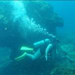
Hi All, I occasionally kite at woodies, and last week did a aerial mapping survey over there. I work for an unmanned aerial vehicle company and noticed (aside from some brilliant stone art on the western groyne - my childish humour?) a lot of murky water on beach 3. Thought it might be a spawning event, but am interested to hear other people's views. Also curious to know what the cable is that runs off to the WSW. Cheers


The brown is probably all the poo in the bushes from illegal camping finally washing into the ocean.
The cable is probably actually a pipeline for cockburn cement plant effluent out to the middle of the sound (just my guess).
I think the brown is from stink weed leaching into the water. I come home with stink weed smell on me some times from there.
I don't think its a cable running WSW. you drive past a pipe above ground that bends down like a knuckle into the ground next to the Sand farm Shed (its also pointing WSW). I think its an intake for water to pump the Silica sand up to the Cement Factory inland.
Can you use your UAV to run this line out to sea and find out. Then I can use my ROV to dive down and we can see what it looks like underwater? ![]()
That meat and Potato rock art is pretty funny. I guess the effort some one took to do it just paid off.
lol at the meat and potato's . fqn gold
the cable i would assume has some military use . if you zoom out on google maps and draw a line it hits garden island
Pipe maybe an emergency outlet from Woodman Point Wastewater Treatment plant see Figure 2: http://epa.wa.gov.au/EPADocLib/320_B356.pdf
Select to expand quotemoon waxing said..
Drilling rig on point in May 1967

That's amazing how the sand has built up from the construction of the groyne. Thanks for all the replies. Yeah, I am sure it is rotting seaweed - that would make sense anyway, and the emergency pipe on that EPA doc doesn't look to go too much further out than we mapped it. Given they thought it could only deal with max inflow in 1988, i wonder where emergency overflow is routed now, as the area has built up.
What was the drilling rig for - Oil? Maybe the brown **** is residual Oil leeching out from the old well.
Anyway we are lucky that all that sand has gathered over the last 50 years to make the rigging area we use for kiting. Just need more car parking spaces now and all will be good.
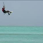
kited in that flat water section in the corner today for the first time. What a awesome spot! My new favorite!
yeah pick your times though - late afternoons and weekends this spot is compact. So many weekend warriors get down there now.
My tip hit the spot early in the afternoons mid week. when the spot gets cramped pack up and have a few cold ones with your mates.
Select to expand quotetopline said..
What was the drilling rig for - Oil? Maybe the brown **** is residual Oil leeching out from the old well.
Anyway we are lucky that all that sand has gathered over the last 50 years to make the rigging area we use for kiting. Just need more car parking spaces now and all will be good.
The rig was drilling for oil: "www.dmp.wa.gov.au/documents/1State_Acreage_Release_L08-6_7_Central_Pth_Bsn.pdf" Drilled 3,054m but didn't hit any oil or gas. Anyway, very off kite related topics now!
Really impressive info guys. Yes off topic but as a geologist, knowing our kite spot was pretty much enhanced by there being a historical drill pad is pretty cool. Also good the hole was dry.