In light of recent posts and comments from contributors re bans and restrictions.
There has been a push for areas subject to possible restrictions to have local codes of conduct posted on signs at the beach.
Seeing as most Aussie kiters have access to seabreeze.com.au and most visiting touro's seem to find it quickly, would it be a good idea to have Seabreeze have a page where you can click on a map and see the local code of conduct for a particular beach?
Who compiles it and updates it?
Who decides the code?
These are questions that could be discussed on this forum.
I suggest local clubs get together and do it. Maybe AKSA could post these local "recommendations" also.
Any comments?
Here's a sample of a map I made to give to visiting kiters and my students when I was instructing. (apologies for business name on pic)

Smooth Dave. BTW the infamous kite eater tree on top of where we have been launching lately has been cut down. There is now heaps of launching space.
Perhaps more information or links to further info should be posted on the kitebeaches website. That's the first place I look at when deciding where to ride when going on an overseas trip.
Great pics though!
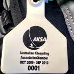
In the UK the BKSA publishes a booklet of locations with information about local rules, launching and landing, tides etc, which you receive when you buy your (compulsory at most beaches) BKSA membership w/ 3rd party insurance.
Good idea! also helpful to new kiters or visiting kiters to find where good spots are and what winds to kite in.
I think its a good idea BUT do we want to advertise a map where all the riding spots are![]()
It's a great idea .. AKSA, WAKSA, KBV, NSWKBA & SAKSA all have seem to have reasonably comprehesive where to/where not kite instructions .. SEQKA have just launched their new site with locations .. maybe you can donate your image to them?
It looks like a "consolidation & expansion" kind of gig to bring all the data together?
Perhaps we can collect information from this topic, and compile it into a "Kiting In Australia" article?
Always stoked to build/publish anything for this site that will help make kiting better for all of us. ![]()
The Noosa 'code of conduct' and kiteing areas are in council being finalized now.I will post it on S.B as soon as possible.
This is our only chance to prove that kiters can self regulate,which will be a precedent for all QLD shires.Being able to be viewed by people on this site will be a very good thing.
great idea,
Why dont we introduce a system like the uk? no need to reinvent the wheel and its national
It is a fantastic idea. I'm sure every kiter would agree (except that one thats always gotta be negative ![]() )
)
Problem is its a huge job for one person or even one organisation to take on.
BUT
If AKSA and the state & local orgs worked more cooperatively things like a national kiting code/registry/site guide (whatever you want to call it) could be easily achievable by a little effort from lots of individuals - with only a small crew needed to co-ordinate it all.
There is plenty of money; there are plenty of kiters keen to see things like this happen; plenty with enough time to put together gudelines etc for their own local spot/s etc etc. and probably a few who would be willing to co-ordinate it if it got enough support.
It wont happen while all that we do is talk about it. But we do need to talk about it, here & elsewhere, to get it going.
Dave's pictures are a work of art, however could be difficult to access for backpackers and euros unsure of where to look for this info. If we could do all spots in Aussie like this and available on Seabreeze it would be great (save a few secret spots though!)
Perhaps local shops / schools together with AKSA (and council approval) erect a large sign at the beach thereby "adopting" their local beach to both advertise themselves and advise of restrictions. Could be a win win for all?
NSWKBA has had maps for the sydney area for a while now, all available in pdf format and given to all local kite shops AND surf shops in areas that are big tourist spots where we do not recommend they kite.

these maps are good as they are all PDF and scalable to print at any size.
I'm willing to go out on a lymb and say that if people send me rough images and help with locations I will produce maps like these for ANYWHERE in Australia as I did these ones.
we're currently working on central coast.. Andy R did you ever get the copy i sent you?
Pete
Great idea to have one centralised spot for Australian kite sites and their local rules/conventions. I am currently travelling down the East Coast in from Cairns to Melbourne in a motorhome. Unlike most Euros in the Wicked vans, we have internet access, but there's still very little info on spots until you get to the major centres.
I'm kitesurfing at any spot that seems good, but local knowledge is hard to come by on the web, and usually available only if you stop someone on the beach and ask them if there's anything to watch/be wary of.
I've had good experiences and bad. Mostly good. Many locals are helpful and even invite me along to downwinders etc. The worst example so far was a bloke who when asked if there was anything to watch out for, be wary of etc said nup, and let me take off straight into a section of large rocks forming a reef in the surf.
I've certainly encountered plenty of people who love to share their spots, and have a great session, I've also run into plenty of people who want to protect their spots and are decidedly unfriendly.
When a great spot is made unridable by the sheer amount of inexperienced kiters in the water, I can see how this attitude can arise. I can also see 35 000 kms of alternative spots on the coastline.
Good info is the key to making all this fit together.
My first point of call is Google earth to look at the coastline, then a quick search with the place name on Seabreeze. Usually it's the advice of locals from the previous spot that sets you in the right direction for the next spot and so on.
Even to begin with a database of NO GO zones would be more helpful than GO zones for the international or interstate traveller.
Seeing as I'm 3 months into the journey, and still not out of Queensland yet - if that database gets up soon, I'll certainly be keen to test it all out over the rest of the journey. Might even be able to assist with some of the info I've picked up on the way.
One thing that might need to happen though is for the info to be in some kind of printed from (or printable) form for the travelers that don't have internet access all the time.
Peanuticus,
What program do you use to produce those maps? I may be able to help depending on what you use and what data is able to be provided.
I would think each state club would be a great place to start, collecting details from their members, councils etc. I have several mapping programs but I think it best to keep the formats consistent across the entire project, enabling the task of maintaining / updating these to be passed on as people have time / inclination to help.