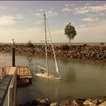
This is possibly a stupid question, but one I've never been able to find an answer to. Why are the tides in Perth quite small in terms of the difference between high and low.
Around the NSW south coast, for example, which isn't significantly different in latitude compared to Perth, tidal movements will be at least a couple of meters. In Perth, movements of under a meter are common. Why is this?
For the same reason they are huge in the Bay of Fundy, Canada. The tide is affected by undersea topography. A"normal " tide is 2ft. Googling will explain it much better than me.
Tides in Perth are tiddlers compared to NSW and Queensland but WA doesn't miss out altogether........................
FREMANTLE TIDES AND CURRENTS
Fremantle tidal movements are mainly diurnal with a small semidiurnal effect evident during neap tides. Astronomical tides range from .66 to 4.6 ft (0.2 to 1.4 m). Port authorities state that the normal extreme range of astronomical tides is 3.9 ft (1.2 m). Tides are measured at five locations throughout the port area.In the entrance channel to the Fremantle Inner Harbor, currents flowing to the south across the Inner Harbor entrance may attain a rate of 1 knot. However, there is no recorded data of current flows during the passage of a tropical cyclone. There are no significant currents in Cockburn Sound.It was reported in the Sailing Directions for the North and West Coasts of Australia (Defense Mapping Agency, 1994b) that after a period of heavy rains, Swan River produced a strong freshet in Fremantle Harbor. This current set obliquely on to Berths 8 and 9 at about 5 knots, then parallel with the jetties, then strongly out of the harbor entrance. In the approach channel to Gage Roads, the current ran out of the harbor at about 4 or 5 knots, setting to the southwest when clear of the South Mole.
Source: www.nrlmry.navy.mil/port_studies/thh-nc/australi/fremantl/text/sect6.htm
DERBY : Greatest tidal range in Australia
It is about 120 km long, and averages about 50 km in width. The port town of Derby lies near the mouth of the Fitzroy River on the eastern shore of King Sound. King Sound has the highest tides in Australia, and amongst the highest in the world, reaching a maximum tidal range of 11.8 metres at Derby.
King Sound - Wikipedia, the free encyclopedia
Now THAT'S a proper tide!!!
Turns out it's a simple question with a complex answer, Google 'Amphidromic point' and report back to us, I can't get my head around it ![]()
Select to expand quoteChris6791 said..
Turns out it's a simple question with a complex answer, Google 'Amphidromic point' and report back to us, I can't get my head around it ![]()
Jeez! I've just woken up after trying to fathom it out. Fell asleep immediately......a narcoleptic tide perhaps?
I thought it was because we don't have daylight saving... Curtains fade, cows get confused, mega tides destroy the beach, school kids confused.....
Much of it comes down to Perth's coastal bathymetry and morphology, and to an extend, the prevailing weather pressure systems.
Globally all the tidal movements and currents are obviously all interconnected and influence each other. Offshore from Perth is just one of many regions where the cumulative influences cause a constant depression of tidal activity.
In a VERY simplified nutshell, the Coriolis effect makes bodies of water swing left or right...which means on a large scale they rotate around a point. That point, called a node, of rotation experiences less motion.

The middle of that simulation is a node and experiences less change than the rest. Offshore of Perth is one of these nodes.
Another way to explain it as I understand it is that the the spinning earth also causes its own tidal movements (Coriolis Effect) like swirling cheap wine in a plastic cup to let it breathe, except it's the whole ocean sloshing around in big circles, the middle of the cup stays the same low level (amphidromic point) while the high point is moving (high tide) and on the opposite side its lower still. The Indian ocean just of Perth just happens to be the middle of the cup and stays pretty much the same level.
Someone correct me if im wrong but thats how my brain is interpreting it?
Then you can also factor in moon and sun gravitational pulls and the lie of the seabed. Net result they all come close to cancelling each other out and we get bugger all tidal range.
Select to expand quoteJulianRoss said..
I thought it was because we don't have daylight saving... Curtains fade, cows get confused, mega tides destroy the beach, school kids confused.....
But we've got switched on cows and pristine curtains here in QLD too and our tides seem to be bigger. What's going on…???
Google is your best bet for this one. But quickly summarized, tides are affected by so much more than just latitude (or longitude for that matter). If you're interested in the science behind it, Wikipedia offers a fairly easy read: https://en.wikipedia.org/wiki/Tide.
Here's a tide map that shows how different areas are affected. 
As you can see, Perth is pretty much in the middle of a dark blue (minimal tide) zone while SA is light blue (somewhat more tide) and NSW greenish yellow (lots more tide). Looking at that map, if you're not a big fan of tides, other places in the world you can visit would be the Caribbean, the Mediterranean, Sea of Japan and some odd spot halfway between NZ and Chile =)
Thanks everyone, been busy this week so haven't had a good chance to review the material, but will do some reading on the weekend.